
Image: Canton1860

Size of this preview: 800 × 457 pixels. Other resolutions: 320 × 183 pixels | 11,680 × 6,672 pixels.
Original image (11,680 × 6,672 pixels, file size: 11.72 MB, MIME type: image/jpeg)
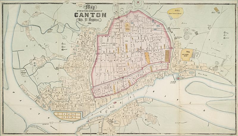
Description: "Map of the City and Entire Suburbs of Canton in 1860 by Rev. D. Vrooman", an updating of Vrooman's 1855 map of the city, incorporating the destruction of the Thirteen Factories, the erection of Shamian, and minor adjustments to his prospective map of the city following its opening to foreign visitors following the treaties of Tianjin and Beijing.
Title: Canton1860
Credit: http://www.nla.gov.au/apps/cdview/nla.map-lms636
Author: Daniel Vrooman
Usage Terms: Public domain
License: Public domain
Attribution Required?: No
Image usage
The following page links to this image:

All content from Kiddle encyclopedia articles (including the article images and facts) can be freely used under Attribution-ShareAlike license, unless stated otherwise.