
Image: Canton River and adjacent islands

Size of this preview: 632 × 599 pixels. Other resolutions: 253 × 240 pixels | 4,952 × 4,695 pixels.
Original image (4,952 × 4,695 pixels, file size: 5.44 MB, MIME type: image/jpeg)
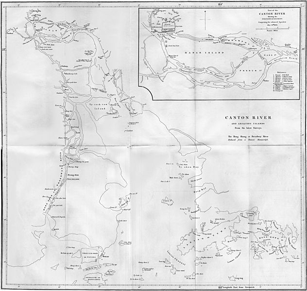
Description: Map of the Canton River and adjacent islands. The inset shows the position of British ships comprising the advanced squadron on 26 May 1841.
Title: Canton River and adjacent islands
Credit: William Dallas Bernard; William Hutcheon Hall (1844). Narrative of the Voyages and Services of the Nemesis, from 1840 to 1843. Volume 1. London: Henry Colburn.
Author: Isaac Purdy
Usage Terms: Public domain
License: Public domain
Attribution Required?: No
Image usage
The following 2 pages link to this image:

All content from Kiddle encyclopedia articles (including the article images and facts) can be freely used under Attribution-ShareAlike license, unless stated otherwise.