
Image: Cape canaveral
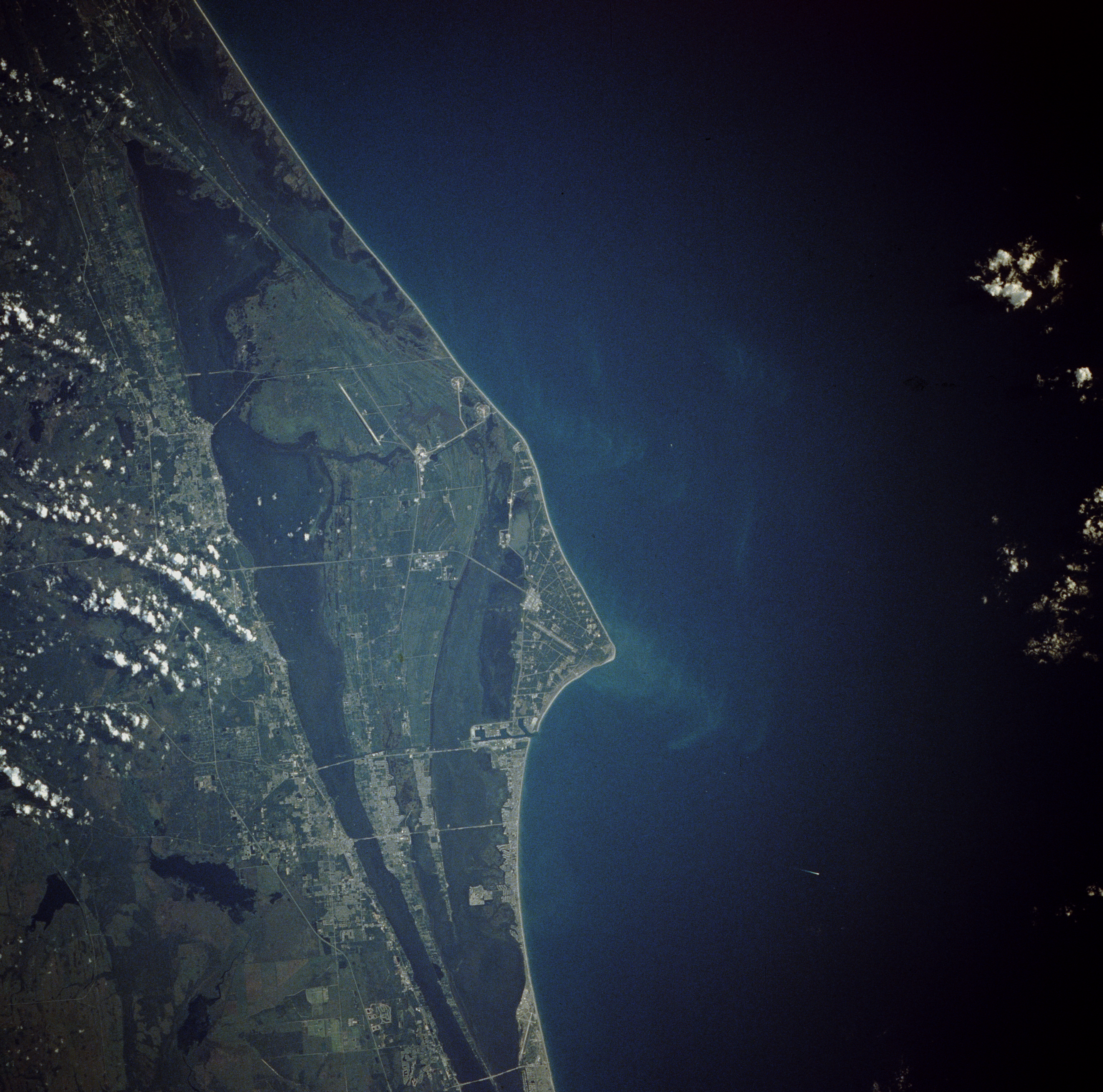
Description: Cape Canaveral, Florida, and the NASA John F. Kennedy Space Center are shown in this near-vertical photograph. Numerous launch pads line the Atlantic Ocean coast near the center of the photograph. To the north of the multiple launch pads, the Space Shuttle landing runway, the Shuttle Assembly Area, and Shuttle Launch Pads A and B are visible. To the south of the multiple launch pads are Port Canaveral and the city of Cocoa Beach, Florida. To the west of the space complex, five causeways span the Indian and Banana Rivers. Interstate Highway 95 is the main artery traversing south to north just west of the Florida cities of Cocoa and Titusville.
Title: Cape canaveral
Credit: Gateway to Astronaut Photography of Earth (image link)
Author: NASA
Permission: This file is in the public domain in the United States because it was created by the Image Science & Analysis Laboratory, of the NASA Johnson Space Center. NASA copyright policy states that "NASA material is not protected by copyright unless noted". (NASA copyright policy page or Conditions of Use of Astronaut Photographs). Photo source: STS043-84-31. Deutsch | English | español | français | italiano | Kurdî | македонски | മലയാളം | português | +/−
Usage Terms: Public domain
License: Public domain
Attribution Required?: No
Image usage
The following 4 pages link to this image:
