
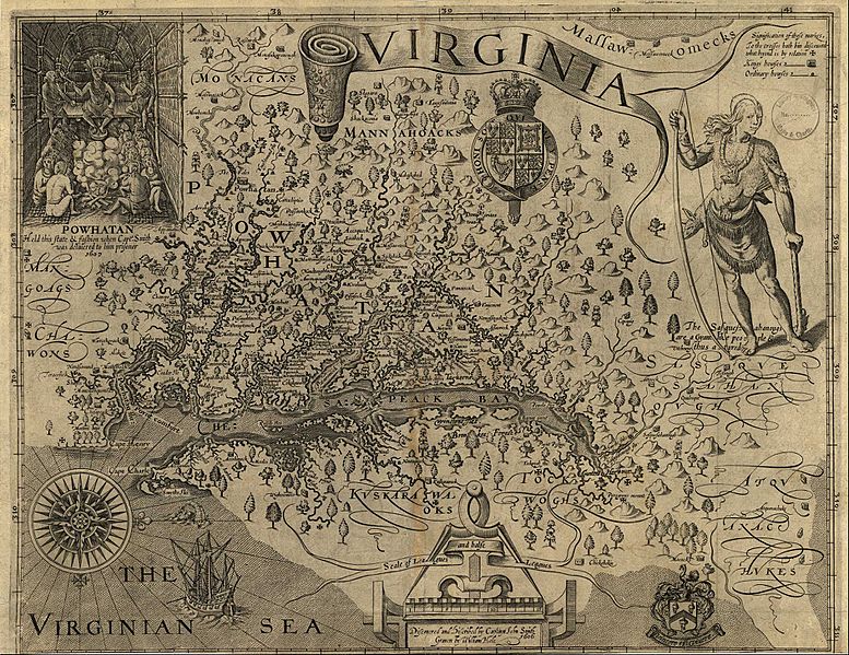
Image: Capt John Smith's map of Virginia 1624

Size of this preview: 777 × 599 pixels. Other resolutions: 311 × 240 pixels | 2,520 × 1,944 pixels.
Original image (2,520 × 1,944 pixels, file size: 1.02 MB, MIME type: image/jpeg)
Description: John Smith, A Map of Virginia: With a Description of the Countrey, the Commodities, People, Government and Religion (1612)
Title: Capt John Smith's map of Virginia 1624
Credit: http://www.virtualjamestown.org/maps1.html
Author: Captain John Smith
Usage Terms: Public domain
License: Public domain
Attribution Required?: No
Image usage
The following 5 pages link to this image:

All content from Kiddle encyclopedia articles (including the article images and facts) can be freely used under Attribution-ShareAlike license, unless stated otherwise.