
Image: CarteDuTunnelMontRoyal
Size of this preview: 800 × 370 pixels. Other resolutions: 320 × 148 pixels | 1,188 × 550 pixels.
Original image (1,188 × 550 pixels, file size: 127 KB, MIME type: image/jpeg)
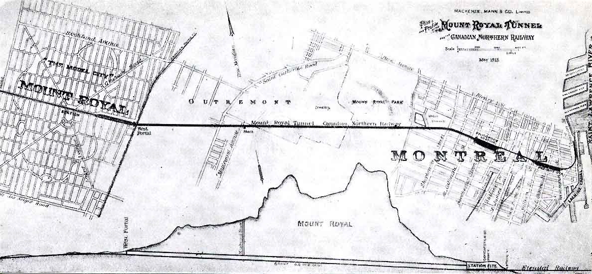
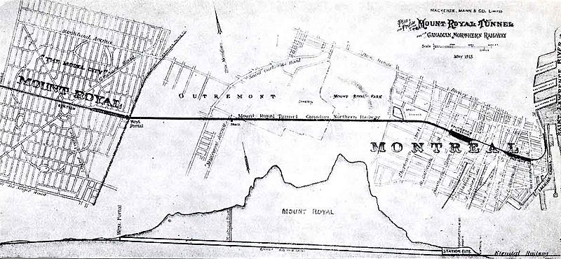
Description: Plan of the “Model City”, Mount Royal for the Canadian Northern Railway showing the proposed street plan as well as the tunnel layout through Outremont to downtown Montréal and cross section of the Mount Royal. Actual street plan is different.
Title: CarteDuTunnelMontRoyal
Credit: Scanned map
Author: MacKenzie, Mann & Co. Ltd
Usage Terms: Public domain
License: Public domain
Attribution Required?: No
Image usage
The following 3 pages link to this image:

All content from Kiddle encyclopedia articles (including the article images and facts) can be freely used under Attribution-ShareAlike license, unless stated otherwise.