
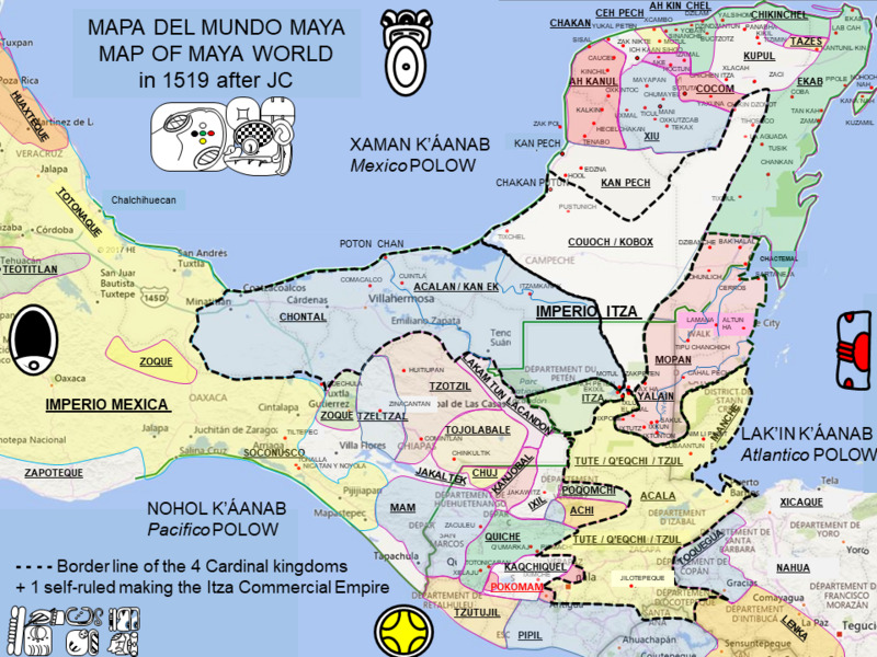
Image: Carte Empire Itza 1519
Size of this JPG preview of this TIF file: 800 × 600 pixels. Other resolution: 320 × 240 pixels.
Original image (960 × 720 pixels, file size: 943 KB, MIME type: image/tiff)
Description: Map fo the maya World at the time of Cortes Arrival in Yucatan and Mexico showing the border of Itza Empire in 1519, 330 000 km2 half of the size of Aztec empire and that will resist 200 years more.
Title: Carte Empire Itza 1519
Credit: Own work
Author: HERVE GALLET
Usage Terms: Creative Commons Attribution-Share Alike 4.0
License: CC BY-SA 4.0
License Link: https://creativecommons.org/licenses/by-sa/4.0
Attribution Required?: Yes
Image usage
The following page links to this image:

All content from Kiddle encyclopedia articles (including the article images and facts) can be freely used under Attribution-ShareAlike license, unless stated otherwise.