
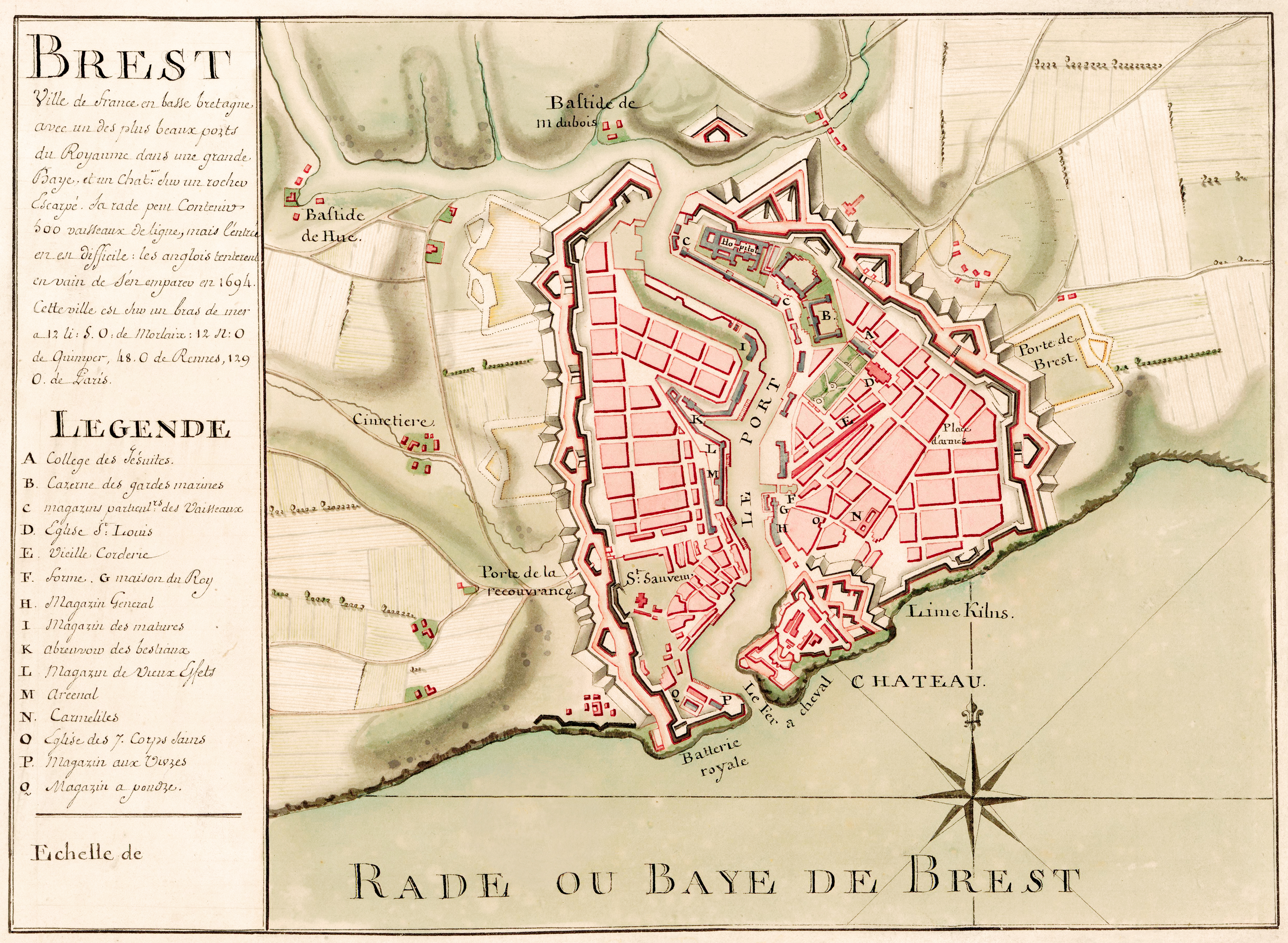
Image: Carte de Brest - ca 1700 - Bibliothèque Nationale de France - Btv1b8439976x
Size of this preview: 800 × 586 pixels. Other resolutions: 320 × 234 pixels | 4,948 × 3,624 pixels.
Original image (4,948 × 3,624 pixels, file size: 12.86 MB, MIME type: image/jpeg)
Description: Title: Brest, city of France in Lower Brittany with one of the Kingdom's largest ports in a large bay. Handwritten cartographic material of the city of Brest and fortifications.
Title: Carte de Brest - ca 1700 - Bibliothèque Nationale de France - Btv1b8439976x
Credit: This image comes from Gallica Digital Library and is available under the digital ID btv1b8439976x
Author: Bibliothèque nationale de France
Usage Terms: Public domain
License: Public domain
Attribution Required?: No
Image usage
The following page links to this image:

All content from Kiddle encyclopedia articles (including the article images and facts) can be freely used under Attribution-ShareAlike license, unless stated otherwise.