
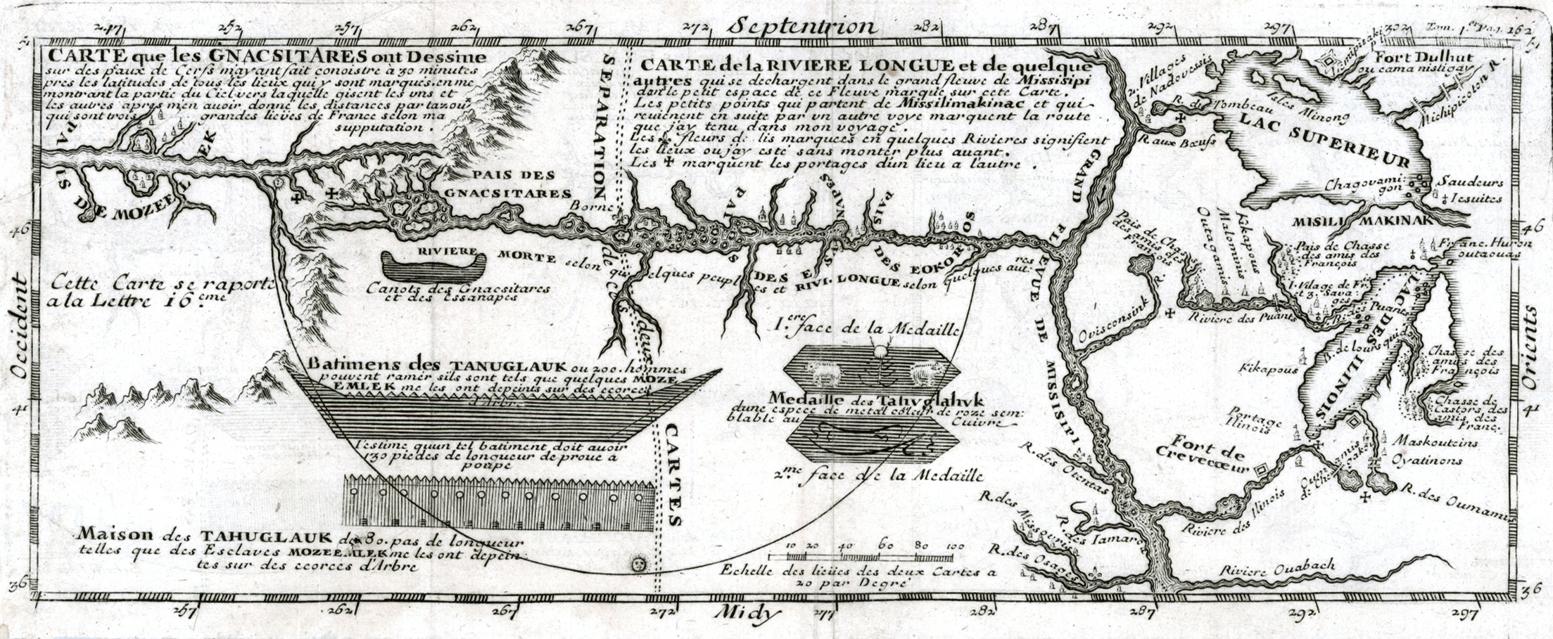
Image: Carte que les Gnacsitares ont Dessine
Size of this preview: 799 × 329 pixels. Other resolutions: 320 × 132 pixels | 2,207 × 909 pixels.
Original image (2,207 × 909 pixels, file size: 1.46 MB, MIME type: image/jpeg)
Description: Map depicting Baron de Lahontan's west-east Long River (Riviere Longue), rising in distant western mountains and emptying into the upper Mississippi. The map extends east to the Great Lakes to show Lac Superieur, and Lac de Illinois (Michigan), along with a number of the early French forts and fur trading outposts.
Title: Carte que les Gnacsitares ont Dessine
Credit: raremaps.com - *
Author: Louis-Armand de Lom d'Arce, Baron de Lahontan
Usage Terms: Public domain
License: Public domain
Attribution Required?: No
Image usage
The following page links to this image:

All content from Kiddle encyclopedia articles (including the article images and facts) can be freely used under Attribution-ShareAlike license, unless stated otherwise.