
Image: Cascadia map and bioregion vector

Size of this PNG preview of this SVG file: 381 × 600 pixels. Other resolution: 152 × 240 pixels.
Original image (SVG file, nominally 1,588 × 2,500 pixels, file size: 381 KB)
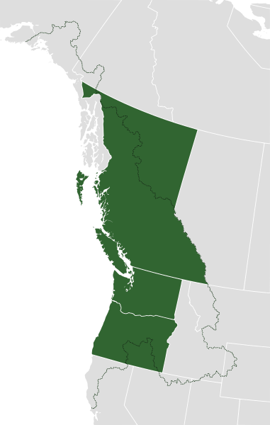
Description: A map showing the two definitions of the proposed "Republic of Cascadia." Green shows the American states of Oregon and Washington; and the Canadian province of British Columbia (which make up the standard definition). The black-dotted line marks the border of the Cascadia bioregion (which is also mentioned as a border).
Title: Cascadia map and bioregion vector
Credit: Derived from File:Cascadia map and bioregion.png
Author: Lucas Thoms; NuclearVacuum
Usage Terms: Creative Commons Attribution-Share Alike 3.0
License: CC BY-SA 3.0
License Link: https://creativecommons.org/licenses/by-sa/3.0
Attribution Required?: Yes
Image usage
The following 2 pages link to this image:

All content from Kiddle encyclopedia articles (including the article images and facts) can be freely used under Attribution-ShareAlike license, unless stated otherwise.