
Image: Cascadia subduction zone USGS

Size of this preview: 420 × 599 pixels. Other resolutions: 168 × 240 pixels | 495 × 706 pixels.
Original image (495 × 706 pixels, file size: 23 KB, MIME type: image/png)
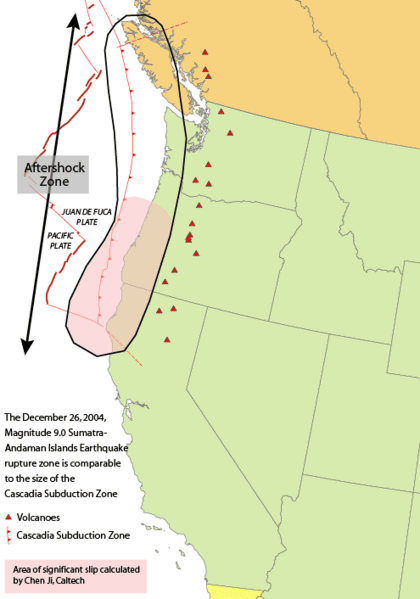
Description: Cascadia subduction zone. This is the site of recurring en:megathrust earthquakes at average intervals of about 500 years, including the en:Cascadia Earthquake of en:1700.
Title: Cascadia subduction zone USGS
Credit: http://earthquake.usgs.gov/eqinthenews/2004/usslav/rupture_area-nw.html, specifically http://earthquake.usgs.gov/eqinthenews/2004/usslav/rupture_area-nw.gif
Author: The original uploader was Curps at English Wikipedia Later versions were uploaded by Remember the dot at en.wikipedia.
Usage Terms: Public domain
License: Public domain
Attribution Required?: No
Image usage
The following 7 pages link to this image:

All content from Kiddle encyclopedia articles (including the article images and facts) can be freely used under Attribution-ShareAlike license, unless stated otherwise.