
Image: Caulfield-Monash-Rowville Tram Melbourne 2018
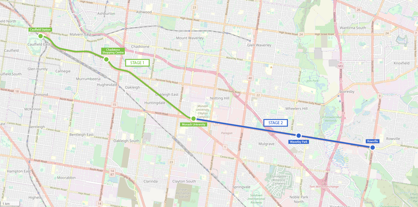
Description: Map showing the proposed tram through Melbourne's south-east suburbs from Caulfield railway station to Chadstone, Monash University, Waverley Park and Rowville. This 2018 proposal is by the State Government of Victoria, and is to be completed in two stages as shown. Stage 1 is shown in Green and runs down Dandenong Road to Monash, Stage 2 is shown in blue and runs down Wellington Road to Rowville. The route and station locations are being investigated and the stations shown on the map are just the ones shown by the State Government. There is a competing plan by the Federal Government for a heavy rail line on a similar corridor. Reference: https://www.abc.net.au/news/2018-04-10/caulfield-to-rowville-tram-route-map/9636070
Title: Caulfield-Monash-Rowville Tram Melbourne 2018
Credit: Own work
Author: Gracchus250
Usage Terms: Creative Commons Attribution-Share Alike 4.0
License: CC BY-SA 4.0
License Link: https://creativecommons.org/licenses/by-sa/4.0
Attribution Required?: Yes
Image usage
The following page links to this image:
