
Image: Cerro volcan curiquinca
Size of this preview: 800 × 492 pixels. Other resolutions: 320 × 197 pixels | 900 × 553 pixels.
Original image (900 × 553 pixels, file size: 270 KB, MIME type: image/jpeg)
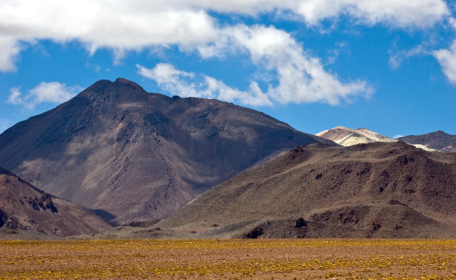
Description: The cerro (volcán) Curiquinca lies at the extreme north of the Sairecabur volcanic complex, and about 4 km (2 mi) south of the Putana volcano. The light area behind the mountain is part of the now abandoned "azufrera El Apagado" sulfur mine.
Title: Cerro volcan curiquinca
Credit: Own work
Author: Gerard Prins
Usage Terms: Creative Commons Attribution-Share Alike 3.0
License: CC BY-SA 3.0
License Link: https://creativecommons.org/licenses/by-sa/3.0
Attribution Required?: Yes
Image usage
The following 2 pages link to this image:

All content from Kiddle encyclopedia articles (including the article images and facts) can be freely used under Attribution-ShareAlike license, unless stated otherwise.