
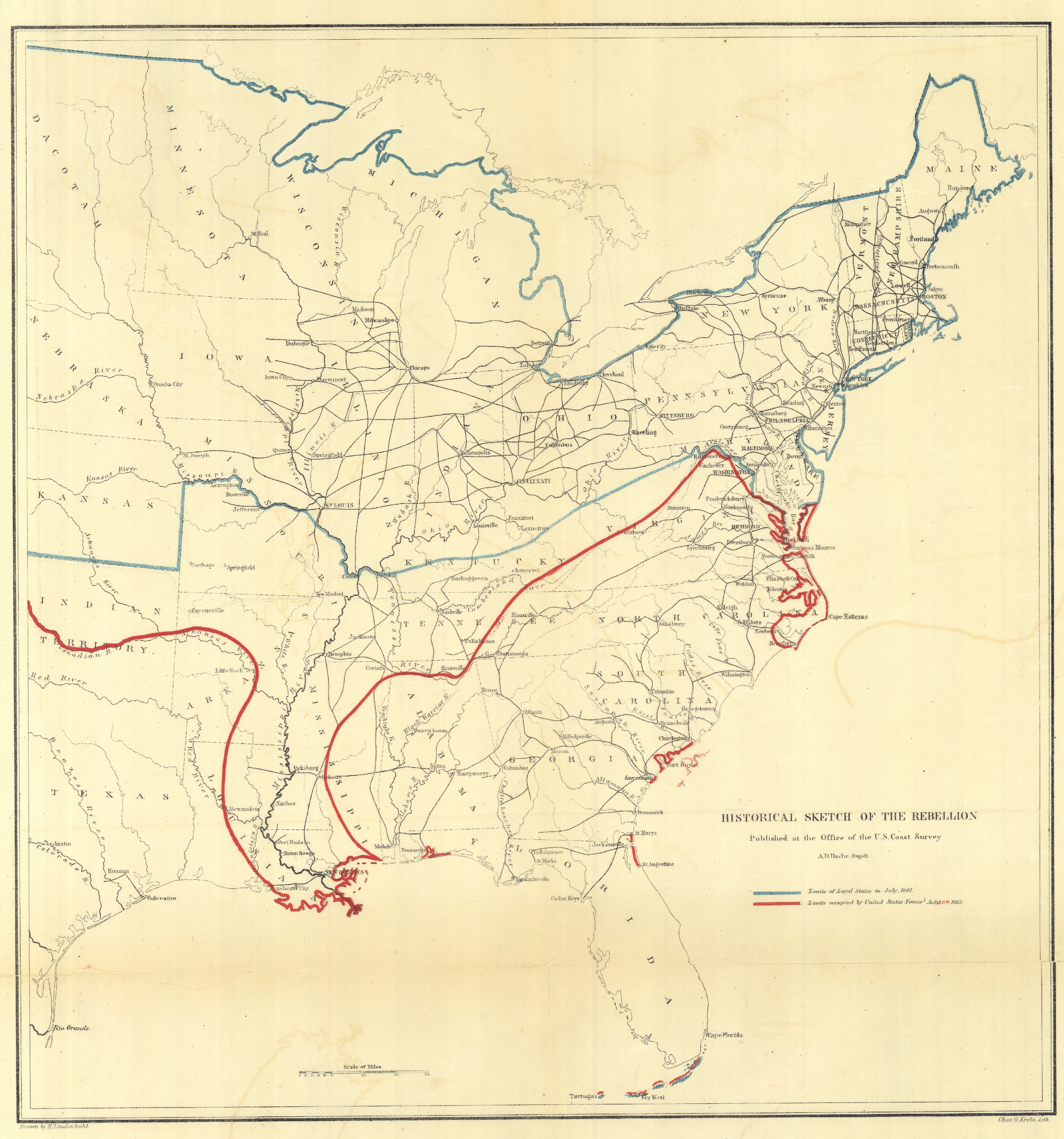
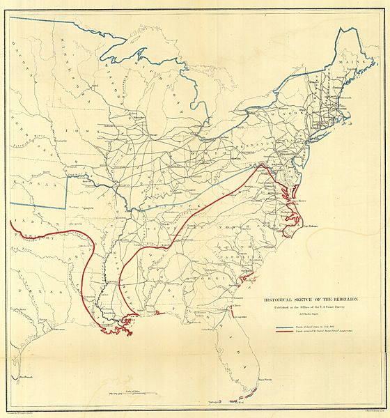
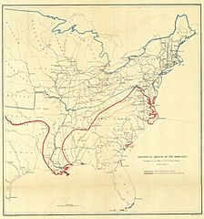
Image: Cgs05255 (9716190703)
Size of this preview: 560 × 600 pixels. Other resolutions: 224 × 240 pixels | 3,753 × 4,018 pixels.
Original image (3,753 × 4,018 pixels, file size: 9.57 MB, MIME type: image/jpeg)
Description: Historical Sketch of the Rebellion, published at the office of the U.S. Coast Survey. This was one of series of maps produced throughout the war showing the progress of Union forces in suppressing the rebellion. This map was dated July 20, 1863. Image ID: cgs05255, NOAA's Historic Coast & Geodetic Survey (C&GS) Collection Location: United States Photo Date: 1863 Credit: NARA C&GS Colllection
Title: Cgs05255 (9716190703)
Credit: cgs05255
Author: NOAA Photo Library
Usage Terms: Creative Commons Attribution 2.0
License: CC BY 2.0
License Link: https://creativecommons.org/licenses/by/2.0
Attribution Required?: Yes
Image usage
The following page links to this image:

All content from Kiddle encyclopedia articles (including the article images and facts) can be freely used under Attribution-ShareAlike license, unless stated otherwise.
.jpg)