
Image: Chaguaramas, 1797 RCIN 735052
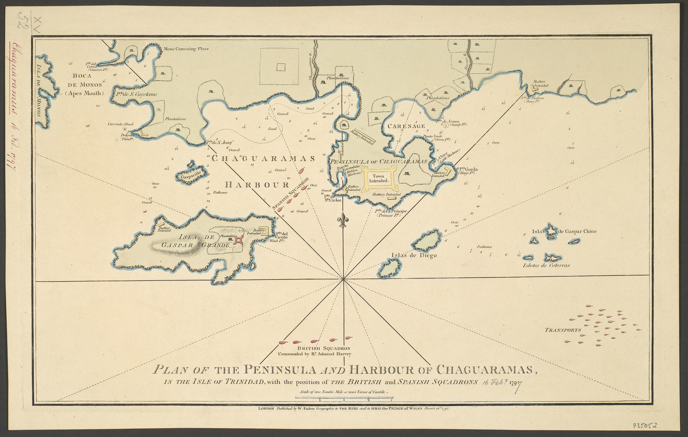
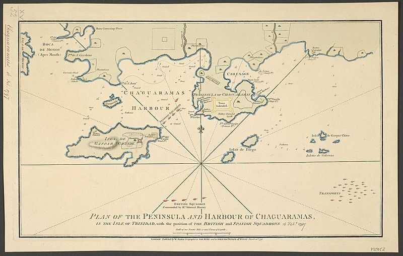
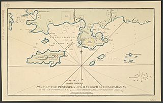
Description: A map of the Peninsula of Chaguaramas in Trinidad and Tobago, showing the positions of the British and Spanish ships on 16 February 1797. Anglo-Spanish War (1796-1808). Oriented with north to top (compass rose). Admiral Hervey, escorting 40 transport ships, took control of Trinidad from the Spanish on 18 February. This map shows the positions of the Spanish and British fleets and the transports, as well as the sites of intended batteries and the proposed site of the new town of Chaguaramas. LONDON Published by W. Faden Geographer to THE KING and to H·R·H· the PRINCE OF WALES March 18.th 1798. George III catalogue entry: Chaguaramas Plan of the Peninsula and Harbour of Chaguaramas in the Isle of Trinidad, with the position of the British and Spanish Squadrons on the 16.th of Feb.y 1797: published by W. Faden, 1798.
Title: PLAN OF THE PENINSULA AND HARBOUR OF CHAGUARAMAS, IN THE ISLE OF TRINIDAD, with the position of THE BRITISH and SPANISH SQUADRONS 16 Feb.y 1797.
Credit: https://militarymaps.rct.uk/french-revolutionary-wars-1792-1802/chaguaramas-1797
Author: William Faden
Usage Terms: Public domain
License: Public domain
Attribution Required?: No
Image usage
The following page links to this image:
