
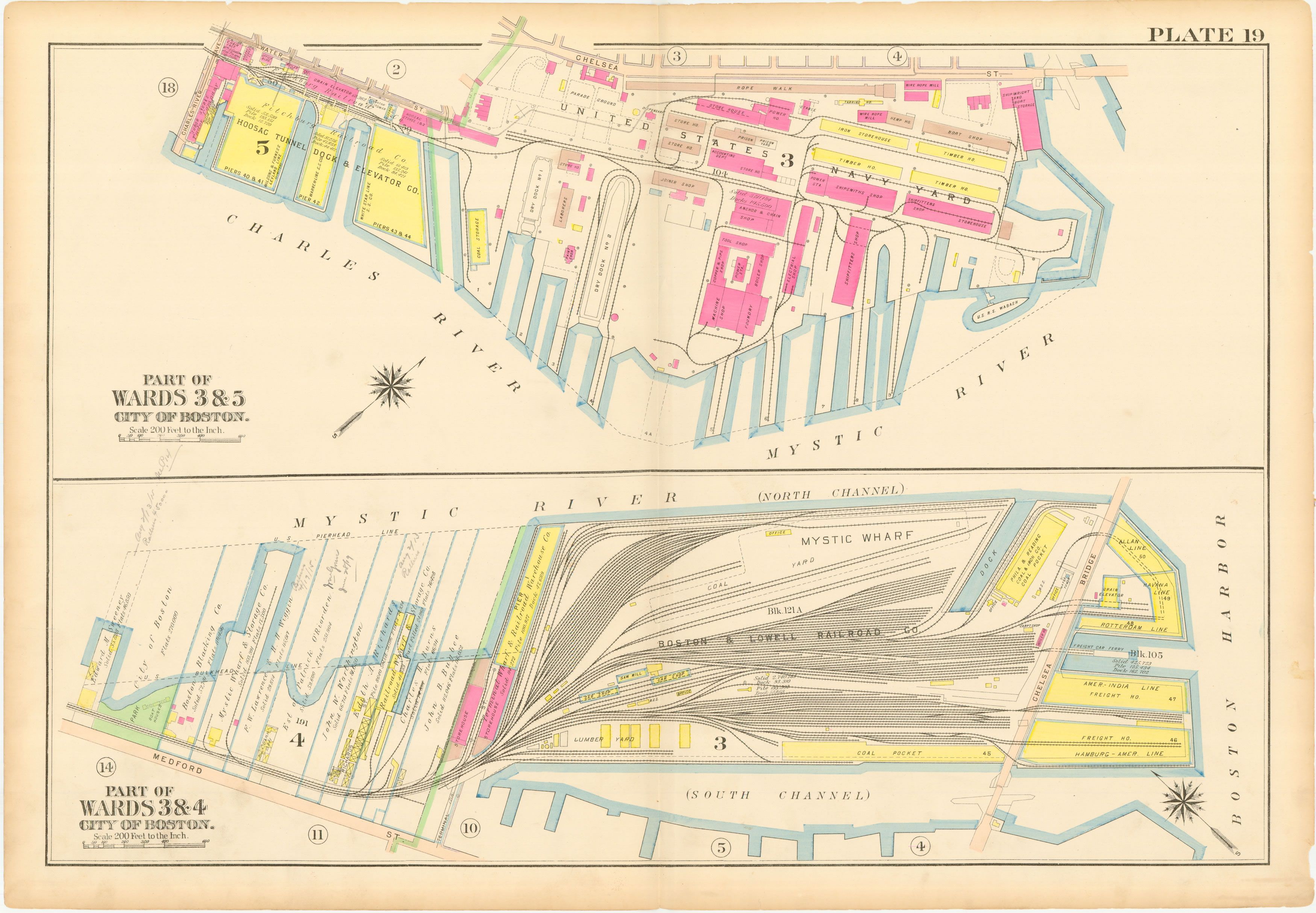
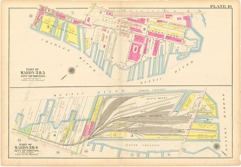
Image: Charlestown Navy Yard Mystic Wharf Map 1912
Size of this preview: 800 × 555 pixels. Other resolutions: 320 × 222 pixels | 3,500 × 2,429 pixels.
Original image (3,500 × 2,429 pixels, file size: 2.87 MB, MIME type: image/jpeg)
Description: This is a map of the Charlestown Navy Yard and Mystic Wharf in 1912. The map is from an atlas of Charlestown, Massachusetts published by GW Bromley. The map's original size is about 22"x32".
Title: Charlestown Navy Yard Mystic Wharf Map 1912
Credit: WardMaps
Author: G.W. Bromley
Usage Terms: Public domain
License: Public domain
Attribution Required?: No
Image usage
The following page links to this image:

All content from Kiddle encyclopedia articles (including the article images and facts) can be freely used under Attribution-ShareAlike license, unless stated otherwise.