
Image: ChathamSunPier4167P
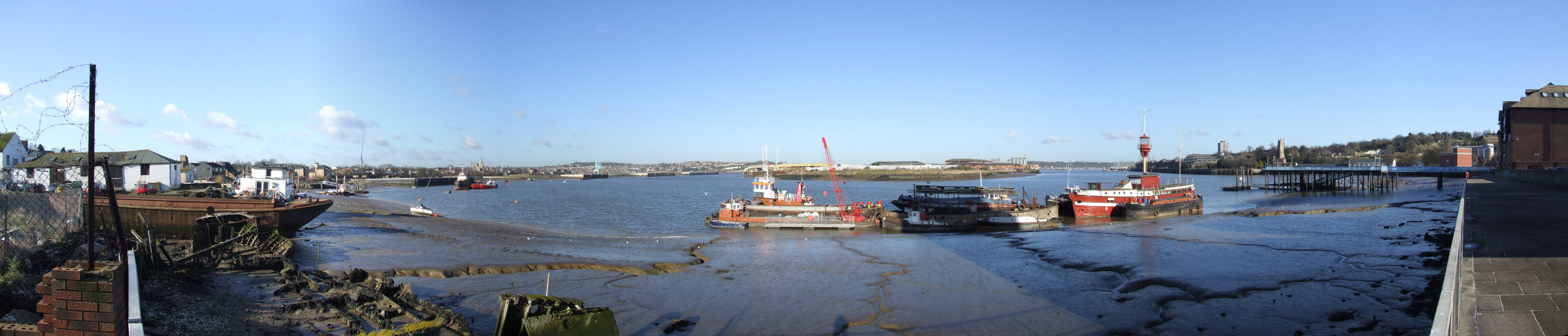
Description: Medway Estuary at Chatham, by Sun Pier. A view of the River Medway Estuary, from Anchorage House Chatham. From Left to Right we see Limehouse Reach with Ship Pier, two trains in Rochester station, Rochester Cathedral and Castle . At Gashouse point the river veers port onto Bridge Reach. On the horizon is Strood and All Saints Frindsbury. In front is the Frindsbury Peninsula and its nearest point is Chatham Ness. Behind the lightship is Chatham Reach. On the left bank we can just see Upnor Castle, and on the horizon Chattenden. On the right bank, we see the buildings of Chatham Dockyard. Then we have Medway Council headquarters, with the flats at Melville Court behind, Chatham Parish Church, the Command House pub, sun pier with the library with Fort Amherst Caveyard behind, the Rats Bay pumping station with Upper Cornwallis battery behind. Camera location 51° 23′ 03.12″ N, 0° 31′ 08.76″ E View this and other nearby images on: OpenStreetMap - Google Earth 51.384200; 0.519100
Title: ChathamSunPier4167P
Credit:
Author: Clem Rutter, Rochester Kent stitched by Marku1988 This panoramic image was created with Autostitch. Stitched images may differ from reality.
Permission: Own work, copyleft: Multi-license with GFDL and Creative Commons CC-BY-SA-2.5 and older versions (2.0 and 1.0)
Usage Terms: Creative Commons Attribution-Share Alike 3.0
License: CC-BY-SA-3.0
License Link: http://creativecommons.org/licenses/by-sa/3.0/
Attribution Required?: Yes
Image usage
The following page links to this image:
