
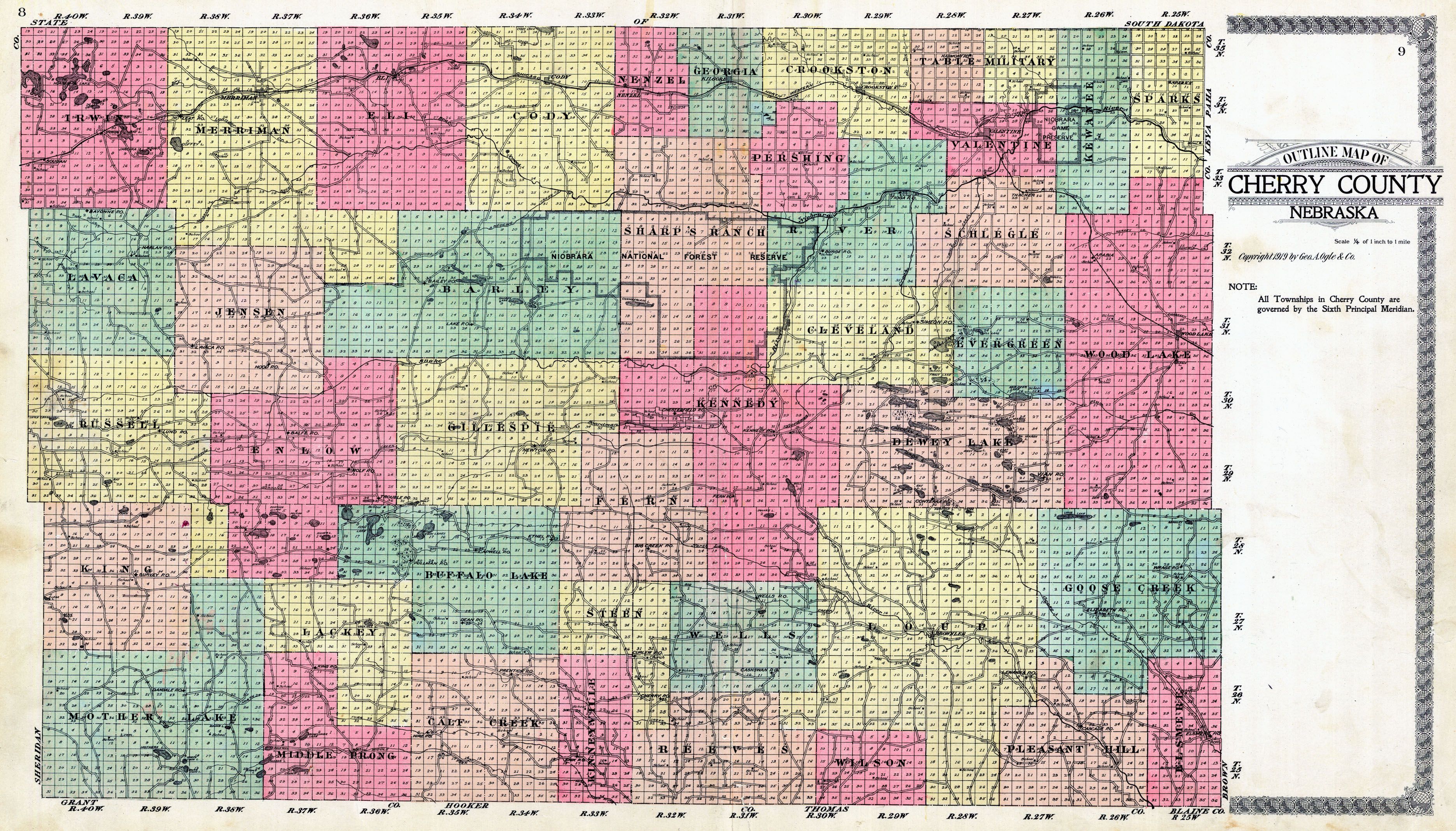
Image: Cherry County Nebraska 1919 map
Size of this preview: 800 × 457 pixels. Other resolutions: 320 × 183 pixels | 3,743 × 2,137 pixels.
Original image (3,743 × 2,137 pixels, file size: 2.38 MB, MIME type: image/jpeg)
Description: map of Cherry County, Nebraska, with precinct subdivision. Original size 74,30 cm x 42,43 cm. Scale 1:253440 or 1/4 of 1 inch to 1 mile)
Title: Cherry County Nebraska 1919 map
Credit: http://www.historicmapworks.com/Map/US/49291/County+Outline+Map/Cherry+County+1919/Nebraska/
Author: Geo. A. Ogle and Co. (publisher)
Usage Terms: Public domain
License: Public domain
Attribution Required?: No
Image usage
The following page links to this image:

All content from Kiddle encyclopedia articles (including the article images and facts) can be freely used under Attribution-ShareAlike license, unless stated otherwise.