
Image: Chesapeakewatershedmap

Size of this preview: 543 × 599 pixels. Other resolutions: 217 × 240 pixels | 1,500 × 1,656 pixels.
Original image (1,500 × 1,656 pixels, file size: 1.16 MB, MIME type: image/png)
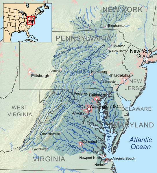
Description: Map showing the Chesapeake Bay drainage basin.
Title: Chesapeakewatershedmap
Credit: Own work, Elevation data from SRTM, hydrologic data from the National Hydrography Dataset, urban areas from Vector Map, all other features from the National Atlas.
Author: Kmusser
Usage Terms: Creative Commons Attribution-Share Alike 3.0
License: CC BY-SA 3.0
License Link: https://creativecommons.org/licenses/by-sa/3.0
Attribution Required?: Yes
Image usage
The following 2 pages link to this image:

All content from Kiddle encyclopedia articles (including the article images and facts) can be freely used under Attribution-ShareAlike license, unless stated otherwise.