
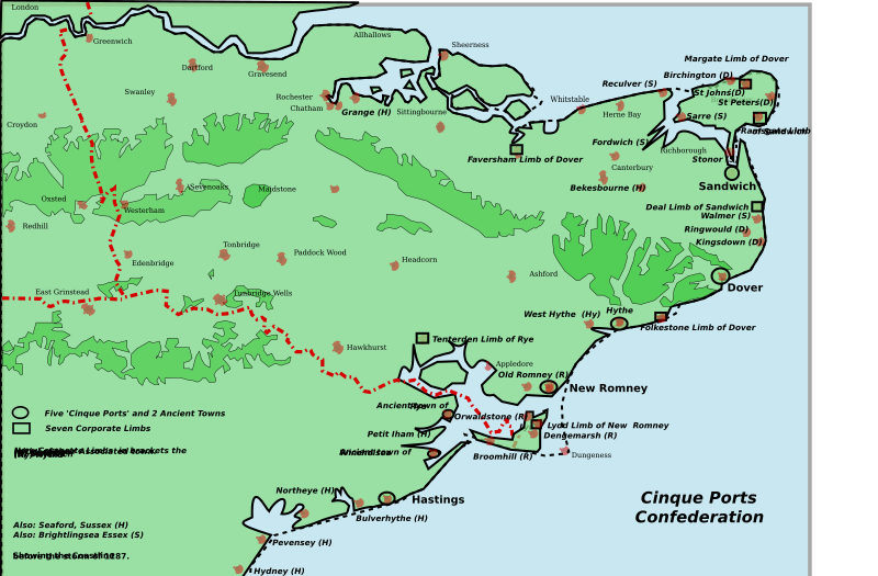
Image: Cinque Ports map

Size of this PNG preview of this SVG file: 800 × 525 pixels. Other resolution: 320 × 210 pixels.
Original image (SVG file, nominally 1,839 × 1,207 pixels, file size: 154 KB)
Description: Map of the Cinque Ports in Kent and Sussex: seven port and their seven limbs and many of the associated limbs. The coastline has changed over the ages: in 1287 a storm caused the silting up of the channel of the River Rother in particular.
Title: Cinque Ports map
Credit: Kent_Cinque_Ports.svgOwn work derivative work: Hogweard (talk)
Author: Kent_Cinque_Ports.svg: Clem Rutter, Rochester, Kent.
Usage Terms: Creative Commons Attribution 2.5
License: CC BY 2.5
License Link: https://creativecommons.org/licenses/by/2.5
Attribution Required?: Yes
Image usage
The following 2 pages link to this image:

All content from Kiddle encyclopedia articles (including the article images and facts) can be freely used under Attribution-ShareAlike license, unless stated otherwise.