
Image: City of West, Texas Fertilizer Plant explosion

Size of this PNG preview of this SVG file: 438 × 599 pixels. Other resolution: 175 × 240 pixels.
Original image (SVG file, nominally 1,151 × 1,574 pixels, file size: 2.55 MB)
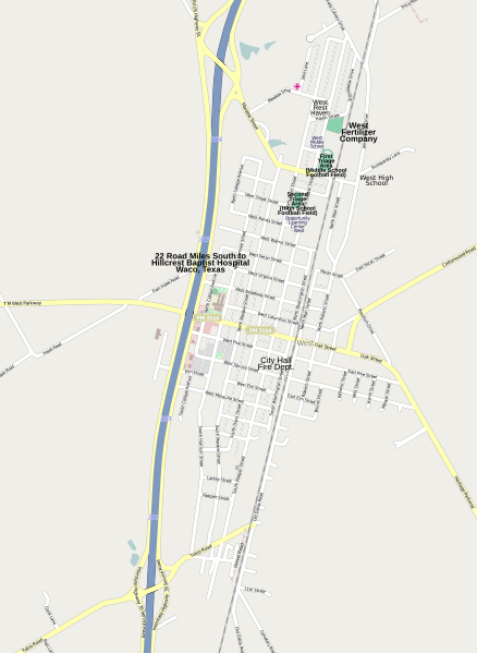
Description: Map of City of West, Texas regarding the West Fertilizer Plant explosion. Includes the triage locations.
Title: City of West, Texas Fertilizer Plant explosion
Credit: http://www.openstreetmap.org/?lat=31.80707&lon=-97.09088&zoom=15&layers=M
Author: OpenStreetMap contributors
Permission: http://www.openstreetmap.org/copyright
Usage Terms: Creative Commons Attribution-Share Alike 2.0
License: CC BY-SA 2.0
License Link: https://creativecommons.org/licenses/by-sa/2.0
Attribution Required?: Yes
Image usage
The following page links to this image:

All content from Kiddle encyclopedia articles (including the article images and facts) can be freely used under Attribution-ShareAlike license, unless stated otherwise.