
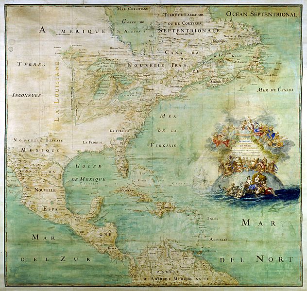
Image: Claude Bernou Carte de lAmerique septentrionale

Description: Map of the northern part and parts of the southern parts of the America, from the mouth of the Saint Laurent River to the Island of Cayenne,with the new discoveries of the Mississipi (or Colbert) River. This map shows the results of the expeditions of Father Marquette and L. Jolliet (1673) and the Cavelier de la Salle expedition in the Mississipi valley. The map shows three forts built between 1679 and 1680: Conty fort (near Niagara Falls), Miamis Fort (south of Michigan lake), and Crèvecœur fort (Left bank of the Illinois River). Mississippi river course is only shown upstream of Ohio confluence.
Title: Claude Bernou Carte de lAmerique septentrionale
Credit: Uploaded by David.Monniaux
Author: Bernou, Claude (b. 16..–d. 17..), Abbot
Usage Terms: Public domain
License: Public domain
Attribution Required?: No
Image usage
The following 6 pages link to this image:
