
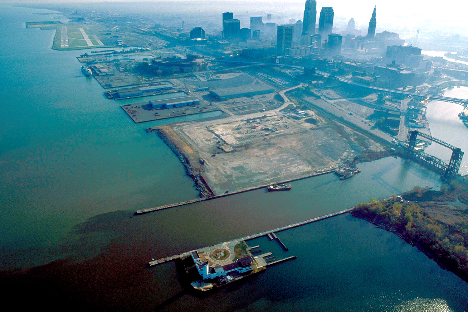
Image: Cleveland Ohio aerial view
Size of this preview: 800 × 534 pixels. Other resolutions: 320 × 214 pixels | 1,500 × 1,001 pixels.
Original image (1,500 × 1,001 pixels, file size: 680 KB, MIME type: image/jpeg)
Description: Aerial view of Cleveland, Ohio, USA, on the shores of Lake Erie. The mouth of the Cuyahoga River is visible in the foreground and Cleveland's Burke-Lakefront Airport is visible in the top left of the picture. View is to the northeast
Title: Cleveland Ohio aerial view
Credit: U.S. Army Corps of Engineers Digital Visual Library Image page Image description page Digital Visual Library home page
Author: Ken Winters, U.S. Army Corps of Engineers
Usage Terms: Public domain
License: Public domain
Attribution Required?: No
Image usage
The following page links to this image:

All content from Kiddle encyclopedia articles (including the article images and facts) can be freely used under Attribution-ShareAlike license, unless stated otherwise.