
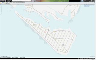
Image: Cobb Island, Maryland, as viewed within the USGS map viewer 201110030252

Size of this preview: 800 × 500 pixels. Other resolutions: 320 × 200 pixels | 1,920 × 1,200 pixels.
Original image (1,920 × 1,200 pixels, file size: 414 KB, MIME type: image/png)
Description: Cobb Island, Maryland, in Charles County, as seen by the USGS National Map Viewer website on October 3rd, 2011.
Title: Cobb Island, Maryland, as viewed within the USGS map viewer 201110030252
Credit: http://viewer.nationalmap.gov/viewer/
Author: United States Geological Survey
Usage Terms: Public domain
License: Public domain
Attribution Required?: No
Image usage
The following page links to this image:

All content from Kiddle encyclopedia articles (including the article images and facts) can be freely used under Attribution-ShareAlike license, unless stated otherwise.