
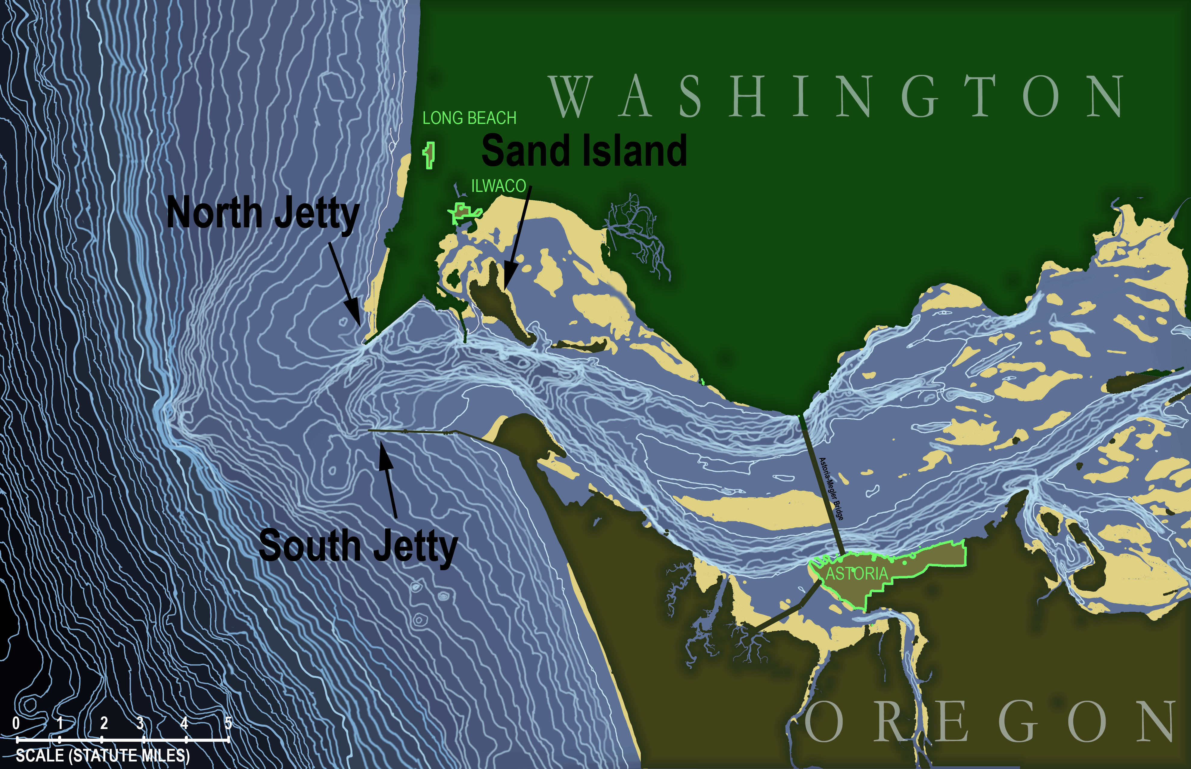
Image: Columbia River Mouth and Bar
Description: Topographic map of the underwater area in and around the mouth of the Columbia River in the state of Oregon, USA. Map is based on soundings in feet taken by the National Oceanic and Atmospheric Administration and published in NOAA navigational chart #18521, "Columbia River - Pacific Ocean to Harrington Point", August 2009 (original chart available here: http://www.charts.noaa.gov/OnLineViewer/18521.shtml) which itself is a public domain image. Topographic lines on this map begin at a depth of 15 feet and occur at 5-foot intervals continuously down to 310 feet (i.e., the edge of the map). Land masses (states of Washington and Oregon) are shown in dark green with urbanized areas highlighted around the edge in bright green. Tidal sand bars are shown in yellow.
Title: Columbia River Mouth and Bar
Credit: Own work
Author: KDS444
Usage Terms: Creative Commons Attribution-Share Alike 3.0
License: CC BY-SA 3.0
License Link: https://creativecommons.org/licenses/by-sa/3.0
Attribution Required?: Yes
Image usage
The following page links to this image:
