
Image: Concord Retreat
Size of this preview: 800 × 342 pixels. Other resolutions: 320 × 137 pixels | 3,235 × 1,381 pixels.
Original image (3,235 × 1,381 pixels, file size: 780 KB, MIME type: image/png)
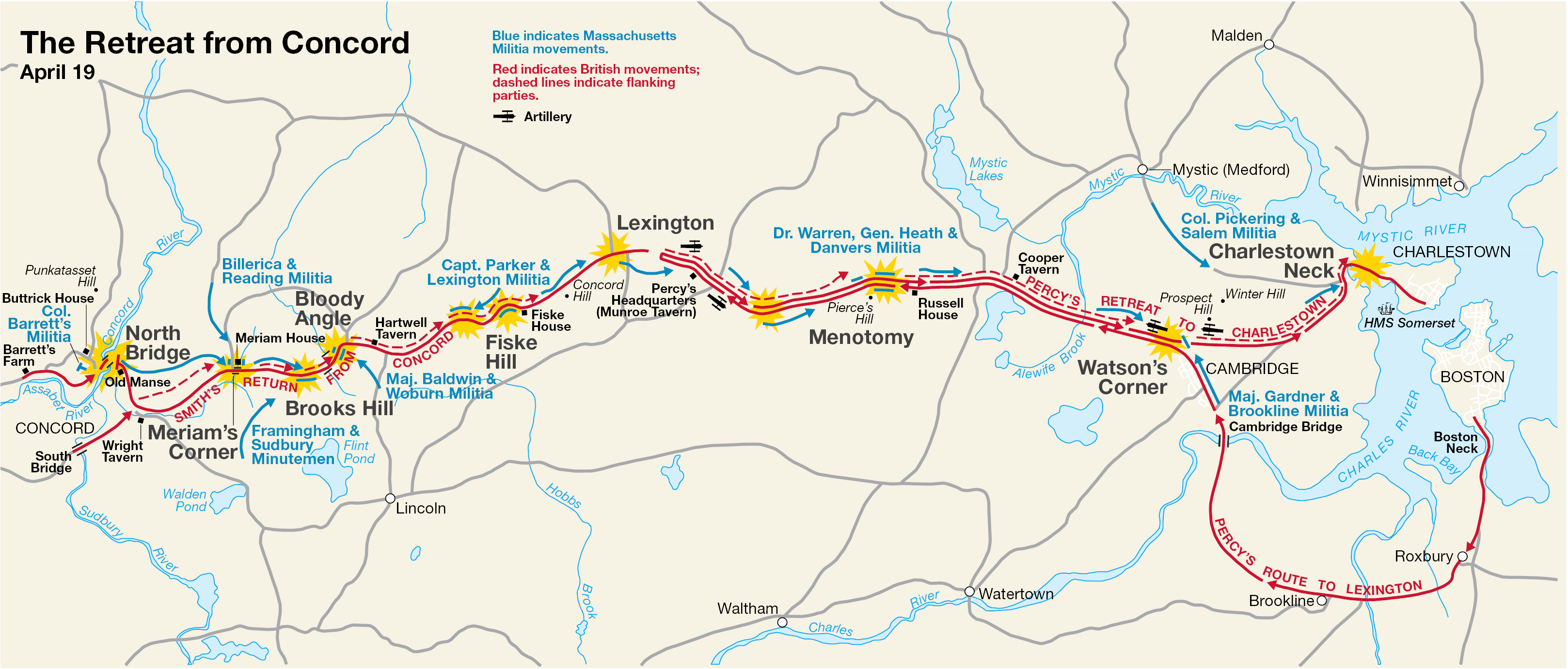
Description: This is a map showing the route of the British army's 18-mile retreat from Concord to Charlestown in the Battles of Lexington and Concord on April 19, 1775. It shows the major points of conflict, as well as showing the route taken by Hugh, Earl Percy's reinforcements.
Title: Concord Retreat
Credit: http://data2.itc.nps.gov/parks/mima/ppMaps/MIMAmap2.pdf
Author: National Park Service
Usage Terms: Public domain
License: Public domain
Attribution Required?: No
Image usage
The following 4 pages link to this image:

All content from Kiddle encyclopedia articles (including the article images and facts) can be freely used under Attribution-ShareAlike license, unless stated otherwise.