
Image: Confederate States map 1861-12-31 to 1865-05-05 (cropped)

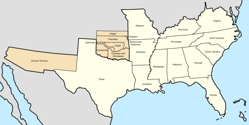
Description: Map of the Confederate States — the 11 states, the two state governments in exile, the one territory, and the 8 allied tribes
Title: Confederate States map 1861-12-31 to 1865-05-05 (cropped)
Credit: This file was derived from: Confederate States map 1861-12-31 to 1865-05-05.png by original author
Author: Original: Golbez Vector: Lieutcoluseng0.
Permission: This file is licensed under the Creative Commons Attribution-Share Alike 4.0 International license. You are free: to share – to copy, distribute and transmit the work to remix – to adapt the work Under the following conditions: attribution – You must give appropriate credit, provide a link to the license, and indicate if changes were made. You may do so in any reasonable manner, but not in any way that suggests the licensor endorses you or your use. share alike – If you remix, transform, or build upon the material, you must distribute your contributions under the same or compatible license as the original. https://creativecommons.org/licenses/by-sa/4.0 CC BY-SA 4.0 Creative Commons Attribution-Share Alike 4.0 truetrue
Usage Terms: Creative Commons Attribution-Share Alike 4.0
License: CC BY-SA 4.0
License Link: https://creativecommons.org/licenses/by-sa/4.0
Attribution Required?: Yes
Image usage
The following 2 pages link to this image:

.png)