
Image: Corinth I Battlefield Mississippi
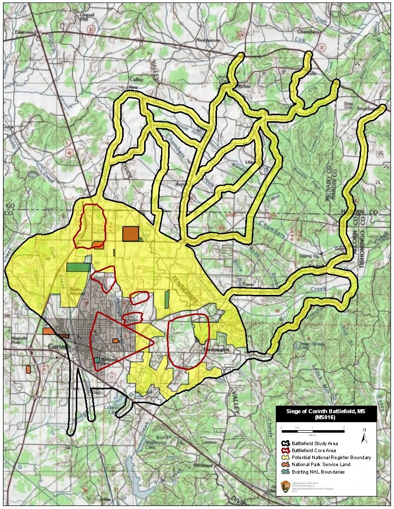
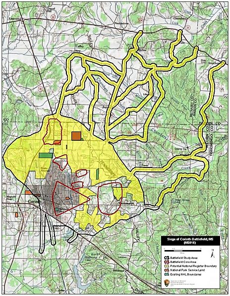
Description: Map of battlefield core and study areas. The historic Memphis and Charlestown Railroad serves as the western edge of the Study Area, while the valley of Sevenmile Creek represents the eastern boundary. The heights surrounding Corinth in the north, which were dominated by Confederate earthworks, and the heights surrounding Corinth in the east, which were used by both Confederate and Federal forces, are included. The ABPP included the multiple converging Federal advance routes from Tennessee to illustrate the importance of Corinth as a regional military objective. The Mobile and Ohio Railroad, used as the Confederate retreat route, was included for its significance as the most direct avenue of escape from Corinth to the south. A large Core Area near Farmington represents the Confederate attack on the isolated Federal Army of the Mississippi on May 9th. The wedge-shaped Core Area represents the Federal bombardment of Corinth and its defenses on May 28th. The northernmost Core Area represents the location of most intense fighting as the Federal Army of the Tennessee advanced down the Purdy Road on May 22. The Core Areas along Phillips and Bridge creeks represent several intense skirmishes, particularly in the area of the Surrett House (May 21-28).
Title: Corinth I Battlefield Mississippi
Credit: National Park Service
Author: American Battlefield Protection Program
Usage Terms: Public domain
License: Public domain
Attribution Required?: No
Image usage
The following page links to this image:
