
Image: Cornwall UK location map

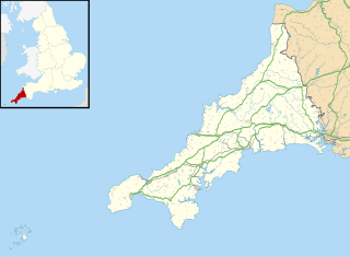
Description: Map of Cornwall, UK with the following information shown: Administrative borders Coastline, lakes and rivers Roads and railways Urban areas Equirectangular map projection on WGS 84 datum, with N/S stretched 150% Geographic limits: West: 6.47W East: 4.00W North: 51.04N South: 49.83N
Title: Cornwall UK location map
Credit: Ordnance Survey OpenData. Administrative borders and coastline data from Boundary-Line product. All other geographic data from Meridian 2 product. Inset derived from England location map.svg by Spischot.
Author: Nilfanion, created using Ordnance Survey data
Permission: This file is licensed under the Creative Commons Attribution-Share Alike 3.0 Unported license. Attribution: Contains Ordnance Survey data © Crown copyright and database right You are free: to share – to copy, distribute and transmit the work to remix – to adapt the work Under the following conditions: attribution – You must attribute the work in the manner specified by the author or licensor (but not in any way that suggests that they endorse you or your use of the work). share alike – If you alter, transform, or build upon this work, you may distribute the resulting work only under the same or similar license to this one. http://creativecommons.org/licenses/by-sa/3.0 CC BY-SA 3.0 Creative Commons Attribution-Share Alike 3.0 truetrue
Usage Terms: Creative Commons Attribution-Share Alike 3.0
License: CC BY-SA 3.0
License Link: http://creativecommons.org/licenses/by-sa/3.0
Attribution Required?: Yes
Image usage
The following 90 pages link to this image:
- All Saints' Church, Tuckingmill
- Asparagus Island
- Black Head (St Austell), Cornwall
- Brisons
- Cadson Bury
- Caerhays Castle
- Camborne School of Mines
- Cape Cornwall Mine
- Carwynnen Quoit
- Castle Goff
- Consolidated Mines
- Craddock Moor stone circle
- Cribbar
- Dodman Point
- Doom Bar
- Duloe stone circle
- East Pool mine
- Eddystone Lighthouse
- Emblance Downs stone circles
- Fernacre
- Geevor Tin Mine
- Goodaver stone circle
- Great Work Mine
- HMS Raleigh (shore establishment)
- Helston Castle
- Holy Trinity Church, Penponds
- Honey Street drill hall, Bodmin
- Ince Castle
- King Arthur's Hall
- Launceston Castle
- Leaze stone circle
- Lesingey Round
- Lizard Lighthouse
- Longships, Cornwall
- Mawgan Porth Dark Age Village
- New Bridge Street drill hall, Truro
- Newquay Bay
- Nine Maidens stone row
- Nine Stones, Altarnun
- Padderbury Top
- Pawton Quoit
- Pendennis Castle
- Penstowe Castle
- Poldice mine
- Poltesco
- RAF Davidstow Moor
- RNAS Tresco
- RRH Portreath
- Restormel Castle
- Roseland Peninsula
- South Crofty
- St Adwen's Church, Advent
- St Bartholomew's Church, Lostwithiel
- St Brevita's Church, Lanlivery
- St Catherine's Castle
- St Colanus' Church, Colan
- St Columba's Church, St Columb Major
- St Julitta's Church, Lanteglos-by-Camelford
- St Martin's Church, Liskeard
- St Martin's Church, St Martin-by-Looe
- St Martin and St Meriadoc's Church, Camborne
- St Mary's Church, East Looe
- St Mary the Virgin's Church, Braddock
- St Mawes Castle
- St Nicholas' Church, West Looe
- St Nonna's Church, Altarnun
- St Senara's Church, Zennor
- St Thomas of Canterbury's Church, Camelford
- St Winnow's Church, St Winnow
- Stannon stone circle
- Stripple stones
- The Gwineas
- Tolvan holed stone
- Tregantle Fort
- Trematon Castle
- Treryn Dinas
- Trethevy Quoit
- Trevelgue Head
- Trippet stones
- Truro Cathedral
- Victoria Barracks, Bodmin
- Warbstow Bury
- Wheal Busy
- Wheal Coates
- Wheal Gorland
- Wheal Jane
- Wheal Metal
- Wheal Peevor
- Wheal Vor
- Template:Location map United Kingdom Cornwall
