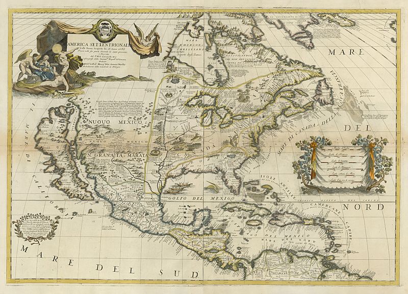
Image: Coronelli America Settentrionale Colle Nuove Scoperti fin all' Anno 1688 UTA

Description: Venetian map and globemaker Father Vincenzo Maria Coronelli's two-sheet map of North America from his Atlante Veneto typifies the southwestern topography found on his globes based largely upon information compiled on his first trip to Paris in 1683-1685. Thanks to French cooperation, he incorporated the latest information from LaSalle's first expedition down the Mississippi in 1682 into a Gulf coastline harking back to Dutch cartographer Gessel Gerritsz, as published by the Blaeus in the 1630s. Unfortunately, LaSalle had been unable to take accurate longitudinal readings with his astrolabe, his measurements for latitude were incorrect, and his compass had broken by the time he had reached the mouth of the great river. LaSalle and his assistants had confused the Mississippi with the Escondido (which scholars equate with the Nueces). Coronelli carefully weighed the sources available and concluded that the Mississippi flowed through what is now Texas! Thanks to information from the Spanish renegade and ex-New Mexico Governor Diego Peñalosa conveyed through the Abbé Claude Bernou, Coronelli correctly depicted the Rio Bravo/Rio del Norte (Rio Grande) flowing from New Mexico, but, like the respected French cartographer Nicolas Sanson, Coronelli accepted the widely-held notion that California was an island.
Title: America Settentrionale Colle Nuove Scoperti fin all' Anno 1688
Credit: UTA Libraries Cartographic Connections: map / text
Author: Vincenzo Coronelli
Usage Terms: Public domain
License: Public domain
Attribution Required?: No
Image usage
The following page links to this image:

