
Image: Coyote Creek (6011498609)

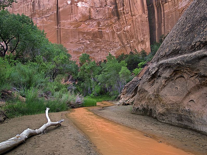
Description: Winding through the Navajo sandstone of Grand Staircase-Escalante National Monument in southern Utah, Coyote Creek has carved out a sinuous canyon about ten miles long, ending at its flow into the Escalante river. The canyon rim rises 200 to 800 feet and typically measures 300 feet from rim to rim. Coyote Gulch, as the canyon is called, contains one natural bridge, one major arch, and numerous alcoves and small waterfalls. Flow rate of the creek depends on recent rainfall in the area. The creek typically runs ankle-deep but after a heavy storm, it can rise to several feet in a swiftly-moving flash flood. this usually happens once every few years. There are several entry points into the canyon. One path involves entering at the terminus near the river and hiking up-canyon in a generally westward direction. Another is a very steep descent mid-canyon from a point just above Jacob Hamblin arch. Also, there are two entry points on the western end: Hurricane Wash and Redwell trailheads. For this trip, I chose the Redwell trailhead and hiked in going down-canyon to Jacob Hamlin arch, where I camped for two nights. The distance was just over nine miles by my GPS. I was carrying about 40 pounds and made it in just over three hours with no rest breaks.
Title: Coyote Creek (6011498609)
Credit: Coyote Creek
Author: John Fowler from Placitas, NM, USA
Usage Terms: Creative Commons Attribution 2.0
License: CC BY 2.0
License Link: https://creativecommons.org/licenses/by/2.0
Attribution Required?: Yes
Image usage
The following page links to this image:

.jpg)