
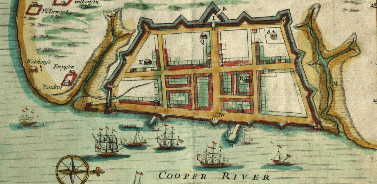
Image: Crisp Map of Charleston in 1711
Description: Crisp Map of Charleston in 1711, where A, E, D, C, and B are the Granville, Ashley, Colleton, Carteret, and Craven Bastions respectively, and I is Johnson's Half Moon, and G is another Half Moon
Title: Crisp Map of Charleston in 1711
Credit: Crisp, E., Nairne, T., Harris, J., Mathews, M. & Love, J. (1711) A compleat description of the province of Carolina in 3 parts: 1st, the improved part from the surveys of Maurice Mathews & Mr. John Love: 2ly, the west part by Capt. Tho. Nairn: 3ly, a chart of the coast from Virginia to Cape Florida. [London: Edw. Crisp, ?] [Map] Retrieved from the Library of Congress, https://www.loc.gov/item/2004626926/.
Author: Crisp, E., Nairne, T., Harris, J., Mathews, M. & Love, J.
Usage Terms: Public domain
License: Public domain
Attribution Required?: No
Image usage
The following page links to this image:
