
Image: Croatia Counties 10th century with Gacka, Krbava, Lika

Size of this preview: 702 × 600 pixels. Other resolutions: 281 × 240 pixels | 1,097 × 937 pixels.
Original image (1,097 × 937 pixels, file size: 644 KB, MIME type: image/png)
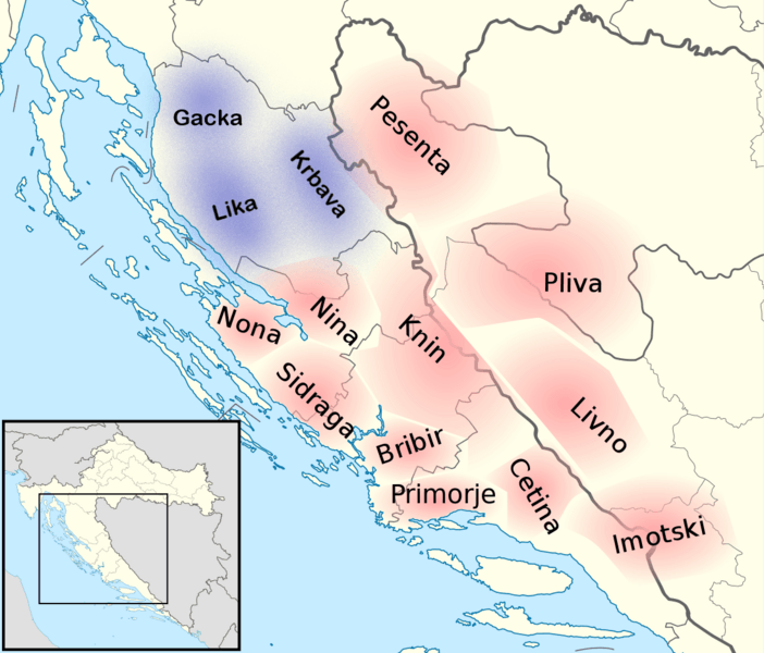
Description: Map of the approximate position of the first fourteen counties, including counties of Gacka, Krbava, and Lika, in the Kingdom of Croatia (10th century). According to: J. Vrbošić, Historical survey of the development of county government and autonomy in Croatia (1992) N. Budak, Hrvatska povijest od 550. do 1100., (2018)
Title: Croatia Counties 10th century with Gacka, Krbava, Lika
Credit: Own work
Author: Miki Filigranski
Usage Terms: Creative Commons Attribution-Share Alike 3.0
License: CC BY-SA 3.0
License Link: https://creativecommons.org/licenses/by-sa/3.0
Attribution Required?: Yes
Image usage
The following 3 pages link to this image:

All content from Kiddle encyclopedia articles (including the article images and facts) can be freely used under Attribution-ShareAlike license, unless stated otherwise.