
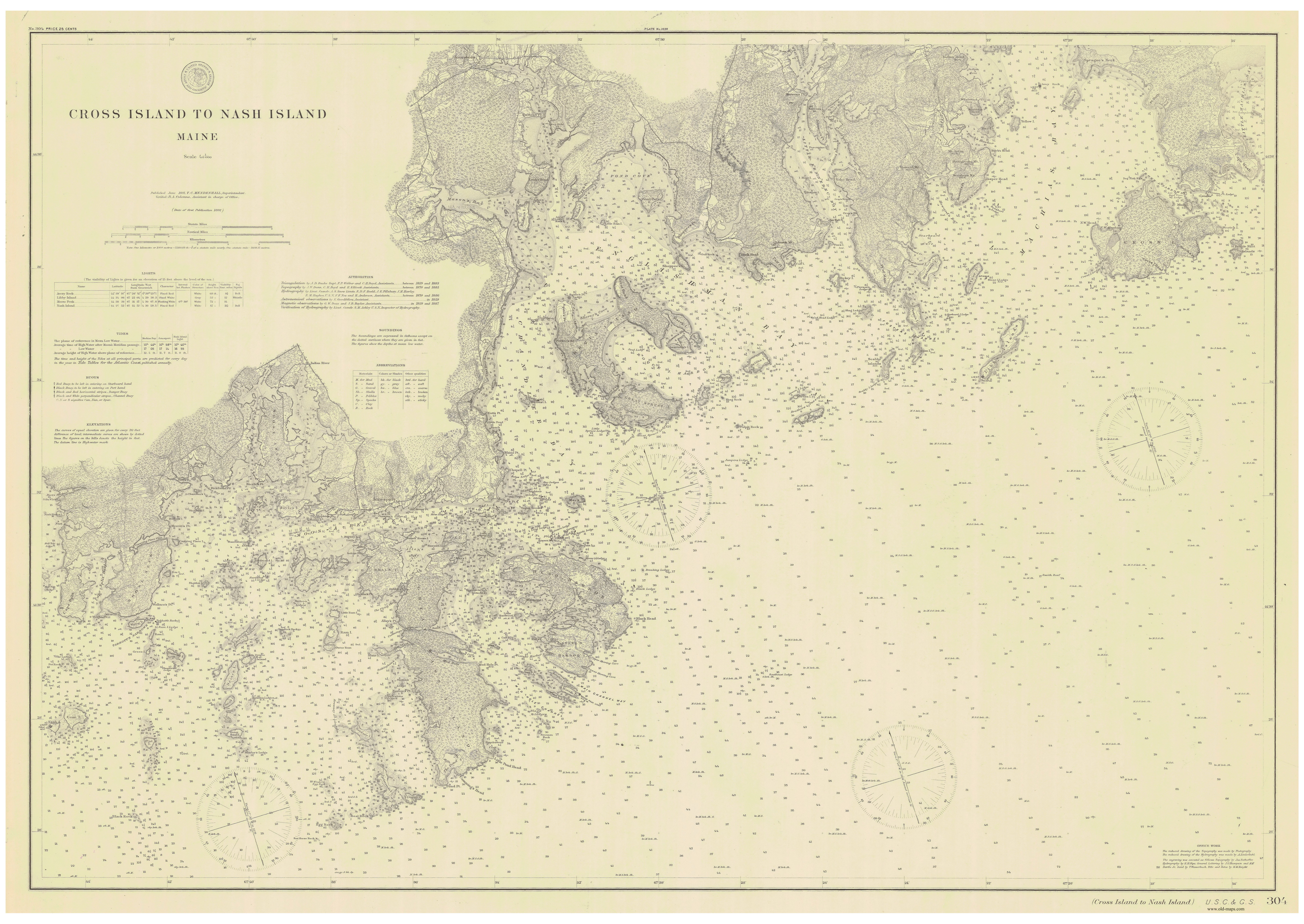
Image: CrossIsland NashIsland 40000 1891 304-06-1891 chart
Size of this preview: 800 × 567 pixels. Other resolutions: 320 × 227 pixels | 5,775 × 4,095 pixels.
Original image (5,775 × 4,095 pixels, file size: 8.47 MB, MIME type: image/jpeg)
Description: Nautical Chart Cross Island to Nash Island, Maine, USA
Title: CrossIsland NashIsland 40000 1891 304-06-1891 chart
Credit: http://www.old-maps.com/nautical/Maine/5_MtDesertIsland_Canada_1ofEach_web/CrossIsland_NashIsland_40000_1891_304-06-1891_web.jpg
Author: T.C. Mendenhall (publisher)
Usage Terms: Public domain
License: Public domain
Attribution Required?: No
Image usage
The following page links to this image:

All content from Kiddle encyclopedia articles (including the article images and facts) can be freely used under Attribution-ShareAlike license, unless stated otherwise.