
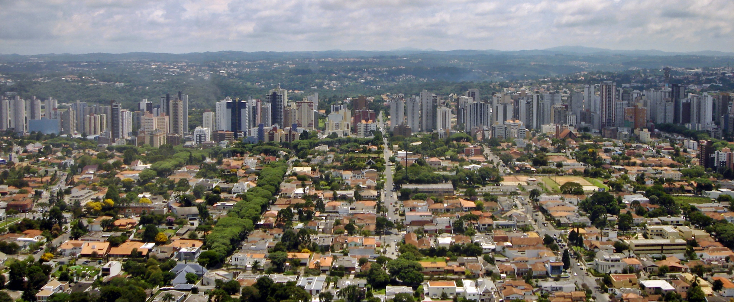
Image: Curitiba Eixos e densidade 02 2006 80
Size of this preview: 800 × 329 pixels. Other resolutions: 320 × 132 pixels | 2,429 × 1,000 pixels.
Original image (2,429 × 1,000 pixels, file size: 1.89 MB, MIME type: image/jpeg)
Description: Aerial view of Curitiba, Brazil. The image illustrates how land use planning allowed high density to develop along Curitiba's BRT corridors
Author: Mariordo (Mario Roberto Durán Ortiz)
Usage Terms: Creative Commons Attribution-Share Alike 3.0
License: CC-BY-SA-3.0
License Link: http://creativecommons.org/licenses/by-sa/3.0/
Attribution Required?: Yes
Image usage
The following page links to this image:

All content from Kiddle encyclopedia articles (including the article images and facts) can be freely used under Attribution-ShareAlike license, unless stated otherwise.