
Image: Czechoslovakia01

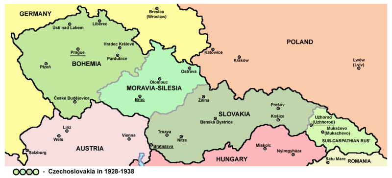
Description: Map of Czechoslovakia in 1928-1938. Note: The provinces shown on the map were introduced by Act No. 125/1927 Zb. and became effective in 1928.
Title: Czechoslovakia01
Credit: Own work Main reference: Map is created according to this external source: http://anamnesis.info/resources/193818BK.gif Secondary references with similar maps: http://terkepek.adatbank.transindex.ro/kepek/netre/163.gif http://terkepek.adatbank.transindex.ro/kepek/netre/166.gif http://academic.evergreen.edu/g/grossmaz/20thCentCzechoslovakia.jpg http://www.philatelicdatabase.com/wp-content/uploads/2008/07/austria-czechoslovakia-hungary-map-1935.jpg http://i2.squidoocdn.com/resize/squidoo_images/-1/draft_lens2183515module12593160photo_1226611649Czechoslovakia1920-38.jpg http://www.probertencyclopaedia.com/photolib/maps/Map%20of%20Czechoslovakia%201938.jpg http://www.probertencyclopaedia.com/photolib/maps/Map%20of%20Czechoslovakia%20%28Political%20Divisions%29%201932.jpg http://www.probertencyclopaedia.com/photolib/maps/Map%20of%20Czecho-Slovakia%201922%20(Czechoslovakia).jpg http://www.ushmm.org/lcmedia/map/lc/image/cze19010.gif http://img443.imageshack.us/img443/821/mapa2tx.jpg http://www.predseda.org/mapy/mapa-ceskoslovensko-hory-reky.jpg http://upload.wikimedia.org/wikipedia/commons/f/f6/Mapa_Československa_1935.jpg http://opevneni.vojenstvi.cz/mapa.jpg http://www.vyvlastnenie.sk/fileadmin/Kauzy/Dialnice/20091203_Mapa_silnicni_magistraly_CSR.jpg http://www.mapaslovakia.sk/userdata/catalog/foto_str35_m83_ceskoslovensko_1919-1938.jpg http://vlastenci.cz/obr/uzemi/stare/1935_Ceskoslovensko_svate.jpg http://www.vltava2000.cz/shops/8532/images-goods/CZ-cela.jpg http://www.tomfijala.cz/bum1939-1945/protektorat/protektorat/help/htmhelp/mapa.jpg http://ces.mkcr.cz/en/img/7/4/0/p2812.jpg http://www.kralovstvimap.cz/php/image.php?image_id=product$4835$1 Secondary references about Geo-political situation - published sources: The Times History of Europe, Times Books, London, 2002. Richard Overy, The Times History of the 20th Century, Times Books, London, 2004. The Times Atlas svjetske povijesti, Cankarjeva založba, Ljubljana - Zagreb, 1986. Istorijski atlas, Geokarta, Beograd, 1999. Školski istorijski atlas, Zavod za izdavanje udžbenika SR Srbije, Beograd, 1970. Povijesni atlas, Učila - Zagreb, Zagreb, 1971. Povijesni atlas za osnovnu školu, Kartografija - Tlos, Zagreb, 1975. Denis Šehić - Demir Šehić, Istorijski atlas sveta, Beograd, 2007. Secondary reference about sizable cities: http://world-gazetteer.com/
Author: PANONIAN This map has been uploaded by Electionworld from en.wikipedia.org to enable the Wikimedia Atlas of the World . Original uploader to en.wikipedia.org was PANONIAN, known as PANONIAN at en.wikipedia.org. Electionworld is not the creator of this map. Licensing information is below.
Permission: I, the copyright holder of this work, release this work into the public domain. This applies worldwide. In some countries this may not be legally possible; if so: I grant anyone the right to use this work for any purpose, without any conditions, unless such conditions are required by law.
Usage Terms: Public domain
License: Public domain
Attribution Required?: No
Image usage
The following 3 pages link to this image:
