
Image: Czechoslovakia 1930 linguistic map - en
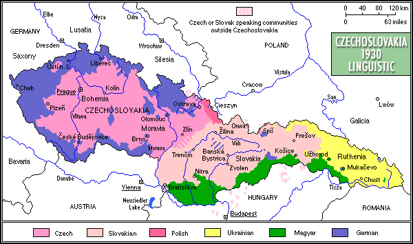
Description: Czechoslovakia 1930: linguistic
Title: Czechoslovakia 1930 linguistic map - en
Credit: Own work The map is based on the following sources: Czechoslovak geographical atlas (1936) map called: Republika Ceskoslovenska. Pomery narodnostni. Polish Geographical Atlas (Powszechny atlas geograficzny), Lwów 1928, map 48. Polish historical atlas (Atlas historyczny świata), Warsaw 1974, p. 120. German historical atlas Westermann Grosser Atlas zur Weltgeschichte, Brunswick 1956, p. 151. German Historischer Atlas, Berlin 1997, p. 99.
Author: Mariusz Paździora
Permission: I, the copyright holder of this work, hereby publish it under the following license:
Usage Terms: Creative Commons Attribution 3.0
License: CC BY 3.0
License Link: https://creativecommons.org/licenses/by/3.0
Attribution Required?: Yes
Image usage
The following page links to this image:
