
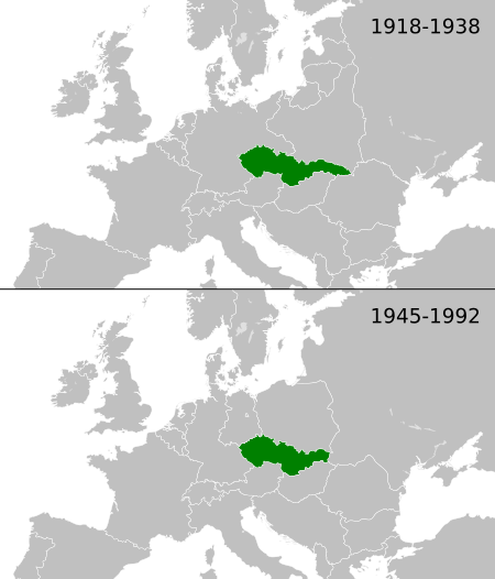
Image: Czechoslovakia location map

Size of this PNG preview of this SVG file: 450 × 526 pixels. Other resolution: 205 × 240 pixels.
Original image (SVG file, nominally 450 × 526 pixels, file size: 931 KB)
Description: Location of Czechoslovakia 1918–1938 and 1945–1992 (other european borders are correct for: 1922–1938 / 1956–1990)
Title: Czechoslovakia location map
Credit: Blank_map_of_Europe.svg
Author: Blank_map_of_Europe.svg: maix¿? derivative work: Alphathon /'æɫfə.θɒn/ (talk)
Usage Terms: Creative Commons Attribution-Share Alike 3.0
License: CC BY-SA 3.0
License Link: https://creativecommons.org/licenses/by-sa/3.0
Attribution Required?: Yes
Image usage
The following page links to this image:

All content from Kiddle encyclopedia articles (including the article images and facts) can be freely used under Attribution-ShareAlike license, unless stated otherwise.