
Image: Départements français d'Algérie 1934-1955 map-fr

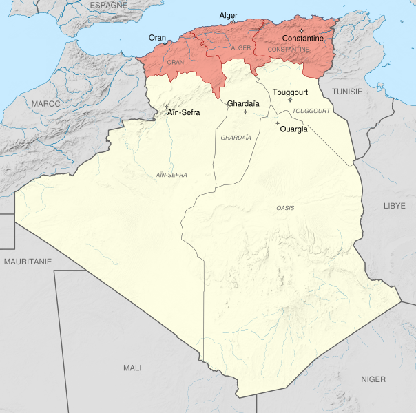
Description: Administrative map of French Algeria from 1934 to 1955, showing the three "Départements français d'Algérie" (French departments of Algeria) in pink: Oran, Alger and Constantine. Scale: 1:6,800,000 (precision: 1,700 m) Equirectangular projection WGS84 datum Central meridian: 001° 39' E Standard parallel: 27° 31' 30" N Geographic limits of the map: Top: 37° 48' N Bottom: 18° 15' N Left: 009° 27' W Right: 012° 45' E
Title: Départements français d'Algérie 1934-1955 map-fr
Credit: This file was derived from: French Algeria 1934-1955 administrative map-fr.svg:
Author: French_Algeria_1934-1955_administrative_map-fr.svg: Sémhur derivative work: Sémhur
Usage Terms: Creative Commons Attribution-Share Alike 4.0
License: CC BY-SA 4.0
License Link: https://creativecommons.org/licenses/by-sa/4.0
Attribution Required?: Yes
Image usage
The following page links to this image:
