
Image: DST Countries Map
Size of this preview: 800 × 401 pixels. Other resolutions: 320 × 160 pixels | 4,972 × 2,492 pixels.
Original image (4,972 × 2,492 pixels, file size: 571 KB, MIME type: image/png)
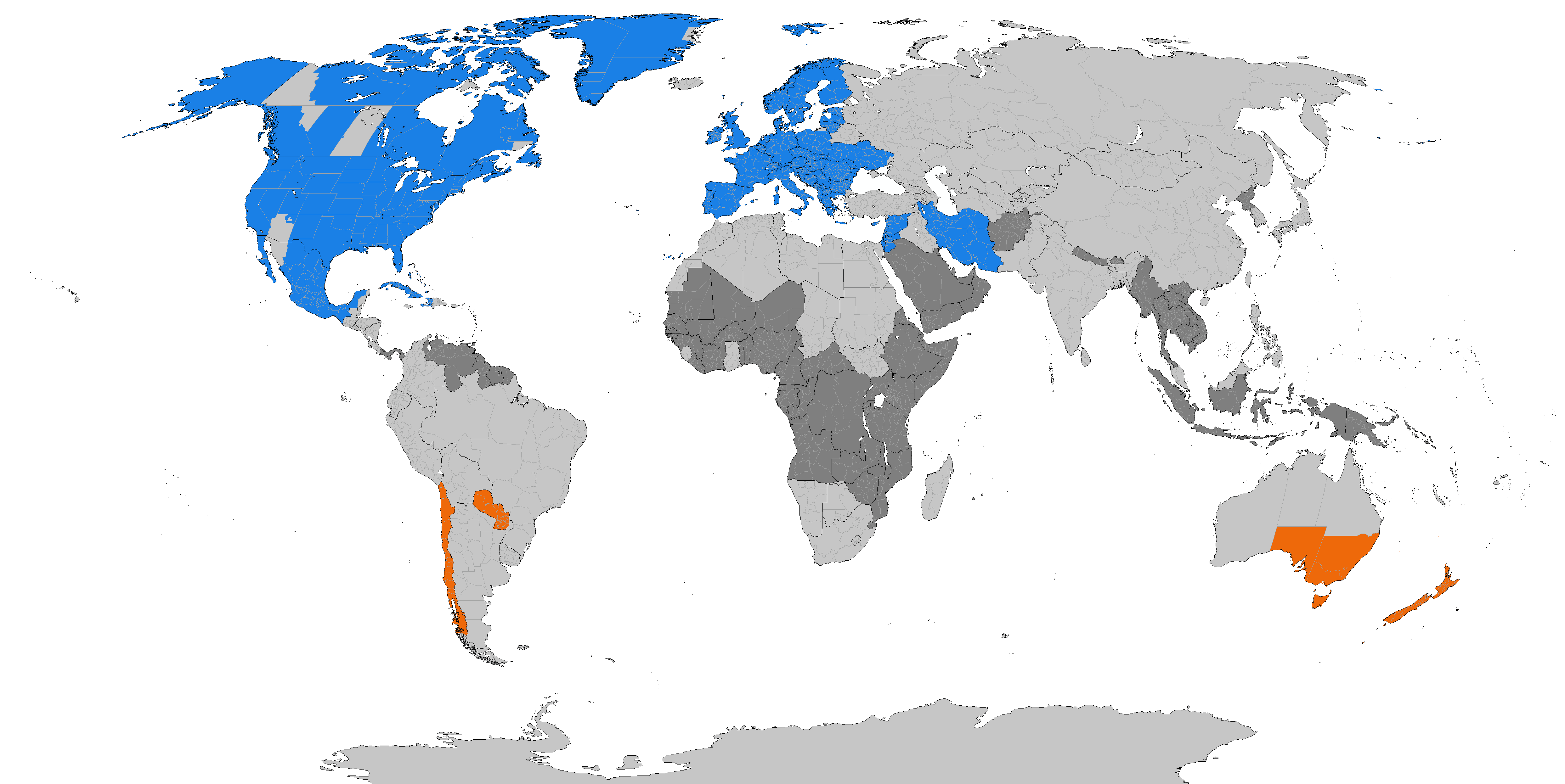
Description: Larger map of the previous version. Distinguished from summertime in the northern hemisphere and southern hemisphere. Northern hemisphere summer Southern hemisphere summer Formerly used daylight savings Never used daylight savings
Title: DST Countries Map
Credit: Own work
Author: TimeZonesBoy
Usage Terms: Creative Commons Attribution-Share Alike 3.0
License: CC BY-SA 3.0
License Link: http://creativecommons.org/licenses/by-sa/3.0
Attribution Required?: Yes
Image usage
The following page links to this image:

All content from Kiddle encyclopedia articles (including the article images and facts) can be freely used under Attribution-ShareAlike license, unless stated otherwise.