
Image: Dadao map 1939

Size of this PNG preview of this SVG file: 634 × 387 pixels. Other resolution: 320 × 195 pixels.
Original image (SVG file, nominally 634 × 387 pixels, file size: 2.15 MB)
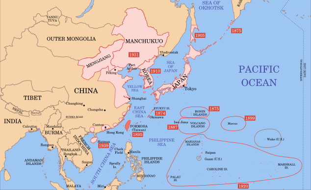
Description: A map of Taiwan, 1939-09-01. Dates shown indicate the approximate year that the various powers gain control of their possessions. Japanese control of territory in China was tenuous.
Title: Dadao map 1939
Credit: modification of File:Mengjiang map 1939.svg
Author: Bamse
Usage Terms: Creative Commons Attribution-Share Alike 3.0
License: CC BY-SA 3.0
License Link: https://creativecommons.org/licenses/by-sa/3.0
Attribution Required?: Yes
Image usage
The following page links to this image:

All content from Kiddle encyclopedia articles (including the article images and facts) can be freely used under Attribution-ShareAlike license, unless stated otherwise.