
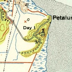
Image: Day Island, USGS map CA Petaluma Point 294067 1951 24000
No higher resolution available.
Day_Island,_USGS_map_CA_Petaluma_Point_294067_1951_24000.png (250 × 250 pixels, file size: 191 KB, MIME type: image/png)
Description: USGS aerial imagery of an island in the w:San Francisco Bay Area. Image cropped from USGS historical map, available from TopoViewer.
Title: Day Island, USGS map CA Petaluma Point 294067 1951 24000
Credit: https://ngmdb.usgs.gov/topoview/viewer/
Author: USGS
Permission: This image is in the public domain in the United States because it only contains materials that originally came from the United States Geological Survey, an agency of the United States Department of the Interior. For more information, see the official USGS copyright policy.
Usage Terms: Public domain
License: Public domain
Attribution Required?: No
Image usage
The following page links to this image:

All content from Kiddle encyclopedia articles (including the article images and facts) can be freely used under Attribution-ShareAlike license, unless stated otherwise.