
Image: De Smet Council Bluffs

Size of this preview: 538 × 600 pixels. Other resolutions: 215 × 240 pixels | 2,154 × 2,401 pixels.
Original image (2,154 × 2,401 pixels, file size: 553 KB, MIME type: image/jpeg)
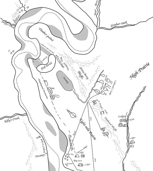
Description: A small portion of Pierre-Jean De Smet's 1839 map of the Council Bluffs Region, traced by the contributor. The area labeled "Caldwell's Camp" was probably near or just southeast of Broadway, the "Fish Pond" is Big Lake Park, and "St. Joseph's" was the Council Bluffs blockhouse.
Title: De Smet Council Bluffs
Credit: The original maps are on file in St. Louis, copies of this map have been widely published. See Journal of the Iowa Archeological Society Vol. 55 (2008) for more info.
Author: Billwhittaker (talk) 18:28, 8 December 2008 (UTC)
Usage Terms: Public domain
License: Public domain
Attribution Required?: No
Image usage
The following 6 pages link to this image:

All content from Kiddle encyclopedia articles (including the article images and facts) can be freely used under Attribution-ShareAlike license, unless stated otherwise.