
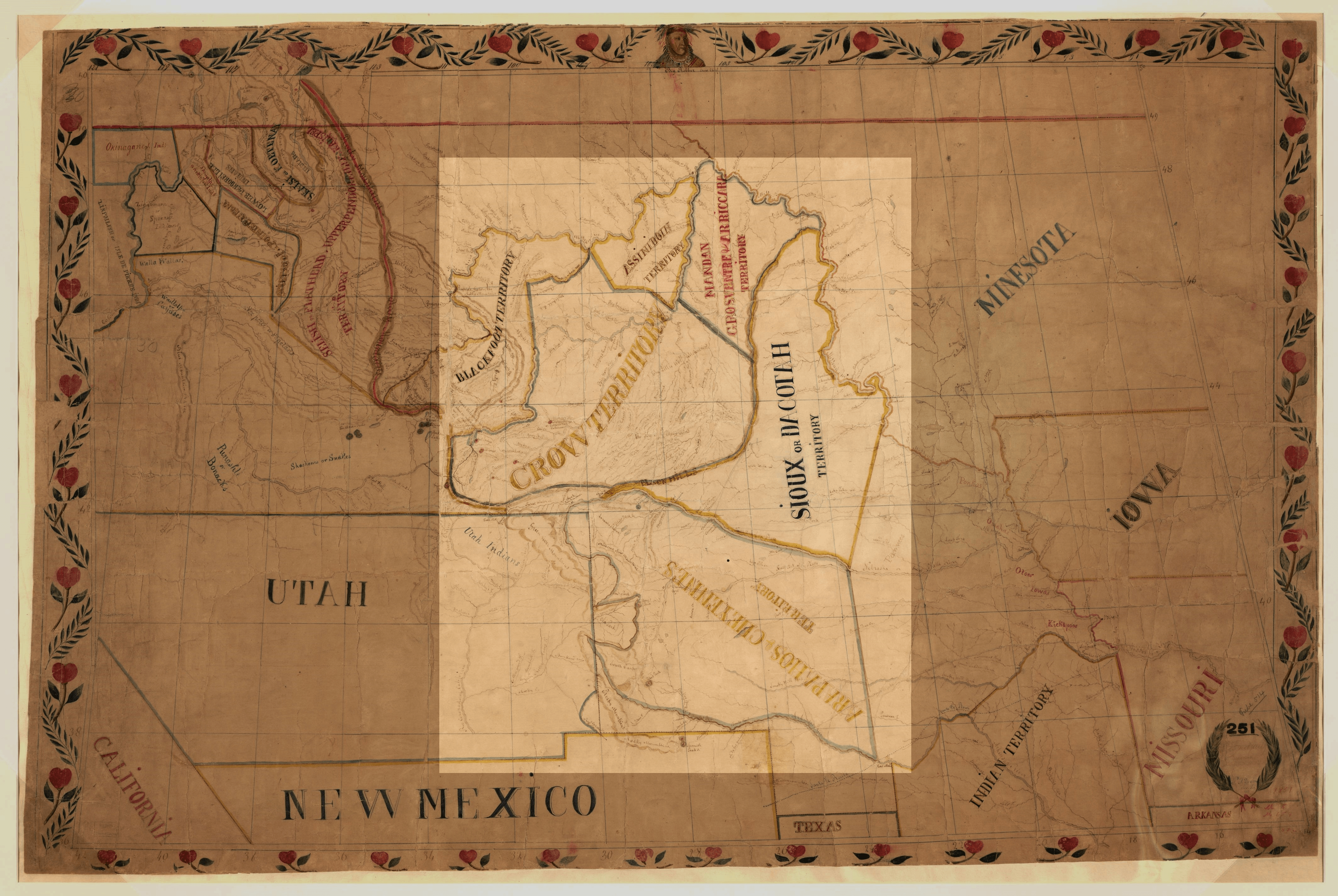
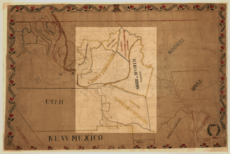
Image: De Smet map of the 1851 Fort Laramie Indian territories (the light area). PNG
Size of this preview: 800 × 536 pixels. Other resolutions: 320 × 214 pixels | 4,255 × 2,849 pixels.
Original image (4,255 × 2,849 pixels, file size: 20.73 MB, MIME type: image/png)
Description: Map of Pierre-Jean De Smet in 1851. The Indian territories agreed upon in the Fort Laramie Treaty (1851) is shown in the light area: Assiniboine, Arikara, Hidatsa and Mandan, Sioux (Dakota or Lakota), Crow, Arapaho and Cheyenne
Title: De Smet map of the 1851 Fort Laramie Indian territories (the light area). PNG
Credit: Map of the upper Great Plains and Rocky Mountains region.
Author: Pierre-Jean De Smet (1801-1873)
Usage Terms: Public domain
License: Public domain
Attribution Required?: No
Image usage
The following 3 pages link to this image:

All content from Kiddle encyclopedia articles (including the article images and facts) can be freely used under Attribution-ShareAlike license, unless stated otherwise.
._PNG.png)