
Image: Demographic map of the Golan Heights - Before 1967 - Legend

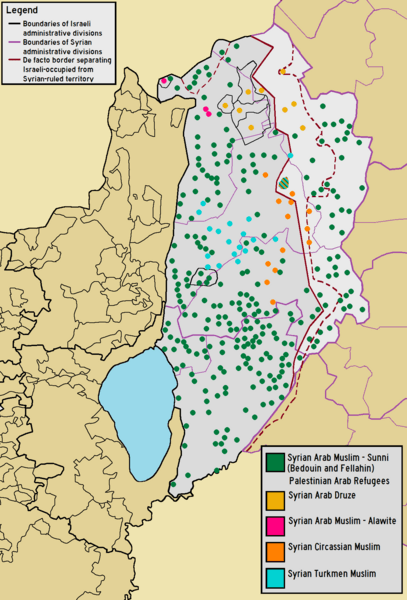
Description: Demographic map of The Golan Heights before the 1967 six day war, including the Israeli-occupied "Golan Subdistrict" and the Syrian-ruled "Quneitra Governorate".
Title: Demographic map of the Golan Heights - Before 1967 - Legend
Credit: Own work using the following information Map of Syrian Subdivisions Israel Antiquities Authority Survey Website where depopulated Syrian villages are shown as "contemporary villages" Map of the names and locations of depopulated localities by Al-Marsad Arab Human Rights Center in Golan-Heights Voices from the Golan Source on population of Palestinian refugees and distribution of ethnic groups in the Golan Heights before 1967
Author: BasilLeaf, using original work created by Bolter21
Usage Terms: Creative Commons Attribution-Share Alike 4.0
License: CC BY-SA 4.0
License Link: https://creativecommons.org/licenses/by-sa/4.0
Attribution Required?: Yes
Image usage
The following 2 pages link to this image:
