
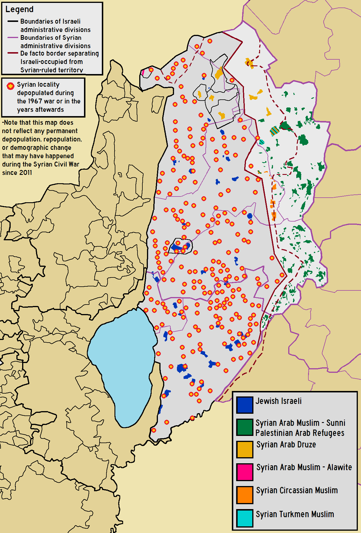
Image: Demographic map of the Golan Heights and Syrian localities depopulated during and after the 1967 War - Legend
Description: Demographic map of The Golan Heights overlaid with location of Syrian localities whose residents have been displaced since 1967, including the Israeli-occupied "Golan Subdistrict" and the Syrian-ruled "Quneitra Governorate".
Title: Demographic map of the Golan Heights and Syrian localities depopulated during and after the 1967 War - Legend
Credit: Own work using the following information Map of Syrian Subdivisions Israel Antiquities Authority Survey Website where depopulated Syrian villages are shown as "contemporary villages" Map of the names and locations of depopulated localities by Al-Marsad Arab Human Rights Center in Golan-Heights 2019 Israeli census Open Street Map and Google Maps for the location and outlines of Syrian and Israeli populated built-up areas
Author: BasilLeaf, using original work created by Bolter21
Usage Terms: Creative Commons Attribution-Share Alike 4.0
License: CC BY-SA 4.0
License Link: https://creativecommons.org/licenses/by-sa/4.0
Attribution Required?: Yes
Image usage
The following 2 pages link to this image:
