
Image: Demopolis Alabama with river confluence

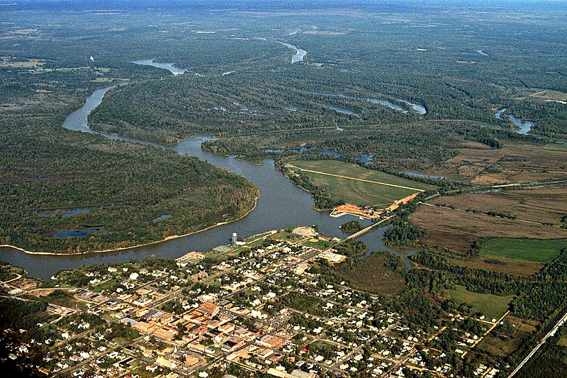
Description: Aerial view of Demopolis, Alabama, USA. The confluence of the Black Warrior River with the Tombigbee River can be seen at center. The Tombigbee is at left the the Black Warrior flows in from the right to join the Tombigbee. The Tombigbee is the border between Sumter County (left) and Greene County (center). The Black Warrior is the border between Green County (center) and Hale County (right). South of the confluence is Marengo County, in which the city is located. View is to the northwest.
Title: Demopolis Alabama with river confluence
Credit: U.S. Army Corps of Engineers Digital Visual Library Image page Image description page Digital Visual Library home page
Author: Adrien Lamarre, U.S. Army Corps of Engineers
Permission: This image or file is a work of a U.S. Army Corps of Engineers soldier or employee, taken or made as part of that person's official duties. As a work of the U.S. federal government, the image is in the public domain. English | italiano | Nederlands | русский | Türkçe | українська | +/−
Usage Terms: Public domain
License: Public domain
Attribution Required?: No
Image usage
The following page links to this image:
