
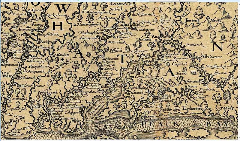
Image: Detail of 1608 Smith Map showing the Patawomeck River

Size of this preview: 800 × 473 pixels. Other resolutions: 320 × 189 pixels | 1,240 × 733 pixels.
Original image (1,240 × 733 pixels, file size: 388 KB, MIME type: image/jpeg)
Description: In 1608, Captain John Smith explored the river now known as the Potomac and made drawings of his observations which were later compiled into a map and published in London in 1612. This detail from that map shows his rendition of the river that the local tribes told him was called the "Patawomeck".
Title: Detail of 1608 Smith Map showing the Patawomeck River
Credit: http://www.virtualjamestown.org/maps1.html
Author: Captain John Smith
Usage Terms: Public domain
License: Public domain
Attribution Required?: No
Image usage
The following 2 pages link to this image:

All content from Kiddle encyclopedia articles (including the article images and facts) can be freely used under Attribution-ShareAlike license, unless stated otherwise.