
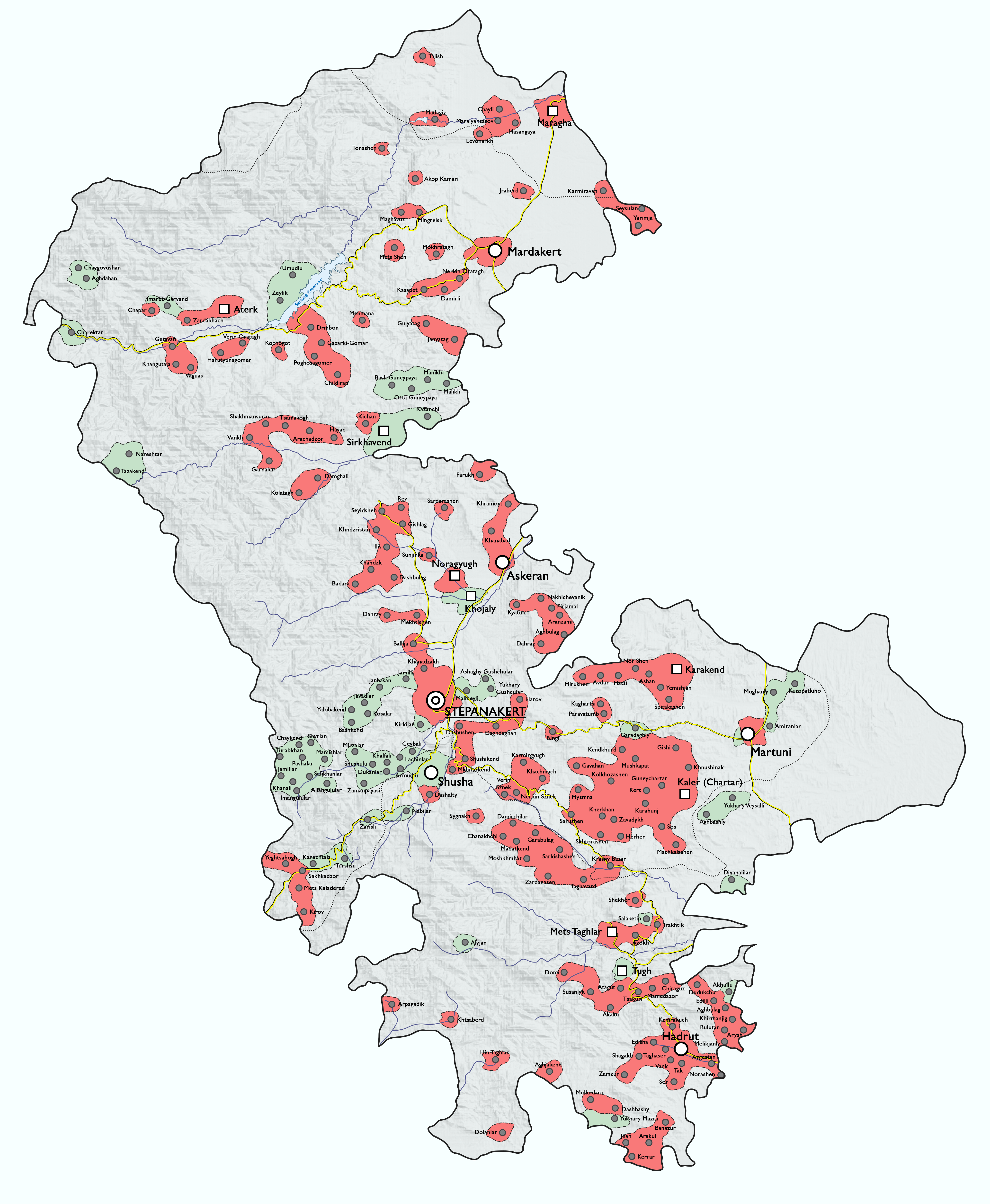
Image: Detailed ethnic map of Nagorno-Karabakh before the First Karabakh War
Size of this preview: 493 × 600 pixels. Other resolutions: 197 × 240 pixels | 4,071 × 4,951 pixels.
Original image (4,071 × 4,951 pixels, file size: 7.62 MB, MIME type: image/png)
Description: Detailed ethnic map of the Nagorno-Karabakh Autonomous Oblast (NKAO) of Azerbaijan SSR before the start of the First Karabakh War. Armenian majority Azerbaijani majority Uninhabited (mountains, farmland, etc.) Frontline following the 2020 war River Highway Place names use their Soviet-era names. Exclaves of and within Nagorno-Karabakh Autonomous Oblast are not depicted.
Author: Golden
Usage Terms: Creative Commons Attribution-Share Alike 3.0
License: CC-BY-SA-3.0
License Link: http://creativecommons.org/licenses/by-sa/3.0/
Attribution Required?: Yes
Image usage
The following page links to this image:

All content from Kiddle encyclopedia articles (including the article images and facts) can be freely used under Attribution-ShareAlike license, unless stated otherwise.