
Image: Devils-Peak Sierra-SanPedroMartir BajaCalifornia Mexico

Size of this preview: 800 × 600 pixels. Other resolutions: 320 × 240 pixels | 2,592 × 1,944 pixels.
Original image (2,592 × 1,944 pixels, file size: 3.24 MB, MIME type: image/jpeg)
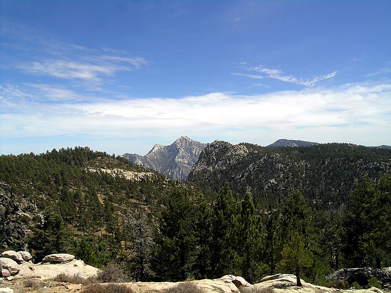
Description: Picacho del Diablo (Devil's Peak) — in the Sierra San Pedro Mártir mountain range of Baja California State, Mexico. Highest point in B.C. state, at 3,078 metres (10,098 ft) in elevation. The Sierra San Pedro Mártir are a range of the Template:Peninsular Ranges System. Seen from the National Astronomical Observatory of Mexico.
Title: Devils-Peak Sierra-SanPedroMartir BajaCalifornia Mexico
Credit: self-made, NIKON E5400, f/7.3, 1/354s
Author: Jaime Sanchez Diaz (jsanchezd)
Usage Terms: Creative Commons Attribution-Share Alike 3.0
License: CC-BY-SA-3.0
License Link: http://creativecommons.org/licenses/by-sa/3.0/
Attribution Required?: Yes
Image usage
The following 5 pages link to this image:

All content from Kiddle encyclopedia articles (including the article images and facts) can be freely used under Attribution-ShareAlike license, unless stated otherwise.