
Image: Districts of Pakistan
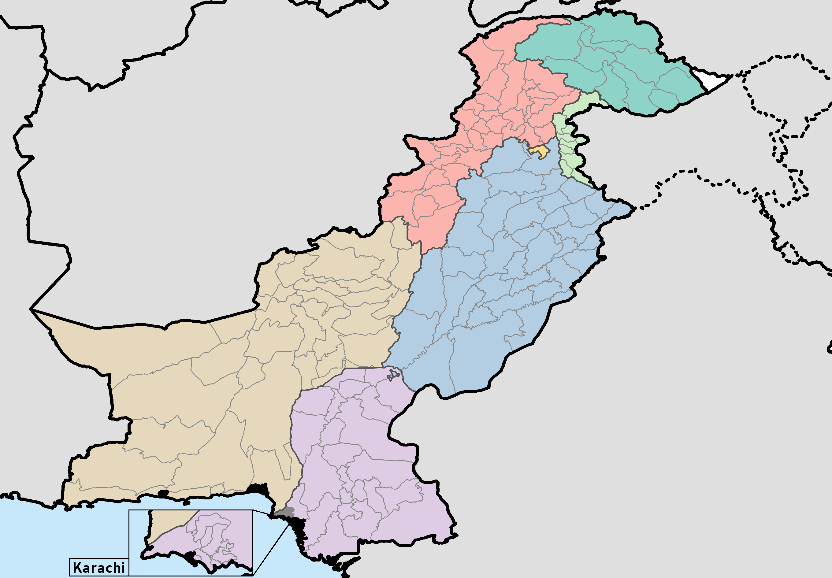
Description: This is a map showing each and every district in Pakistan, including Azad Jammu & Kashmir and Gilgit-Baltistan. It was made using maps from the Pakistan Bureau of Statistics and UN OCHA's HumData Database (which citypopulation.de uses). It is up to date and shows each and every district in Balochistan, Azad Jammu & Kashmir, Khyber Pakhtunkhwa, Punjab, Sindh, and the ICT as of September 30, 2020. I haven't been able to find any official maps showing the borders of Gilgit-Baltistan's four new districts (specifically Darel District, Tangir District, Yaseen District, and Rondu District), so these are not depicted. Only the ten districts dating to the 2017 census are depicted. If anyone can find any official maps for these districts (all fourteen districts), let me know on my talk page and I'll update this map as promptly as I can. The same map with Karachi's districts merged into one can be found here. The same map with a transparent background can be found here if you want one with Karachi's districts shown and here if you want one without them. The same map with a transparent background and that excludes outside international borders (such as the Afghanistan-Iran border or the Indian coastline) can be found here if you want one with Karachi's districts shown and here if you want one without them. A category full of these maps listed nicely can be found here.
Title: Districts of Pakistan
Credit: Own work
Author: Abdullah Ali Abbasi
Usage Terms: Creative Commons Attribution-Share Alike 4.0
License: CC BY-SA 4.0
License Link: https://creativecommons.org/licenses/by-sa/4.0
Attribution Required?: Yes
Image usage
The following page links to this image:
